Coast Autonomous equips its driverless shuttle with Ellipse-D
Our inertial sensor is part of our customer’s 7-layer mapping and localization system for autonomous shuttle solution.
“Ellipse-D is a fully integrated INS/GNSS, very easy to implement in our solution.” | Coast Autonomous

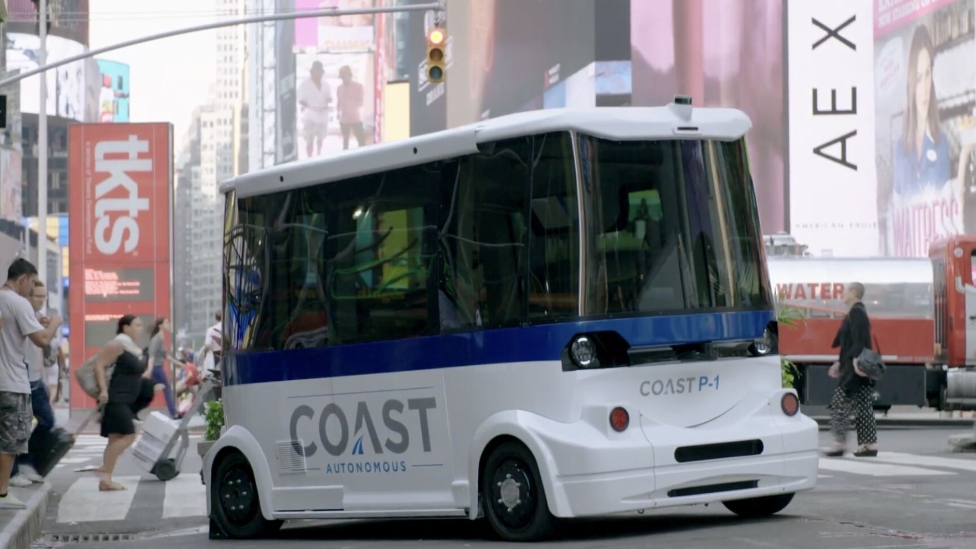
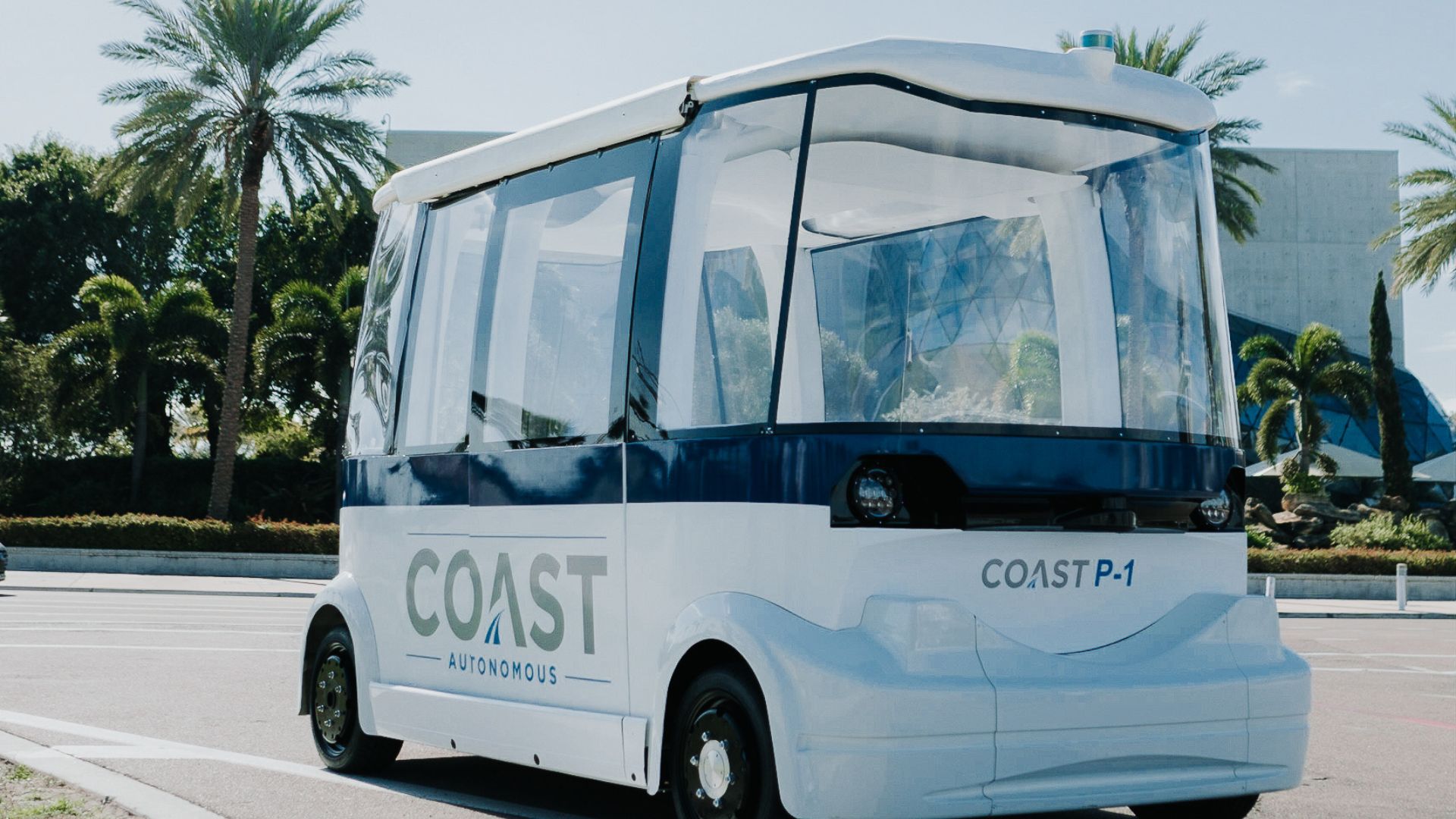
Our esteemed partner Coast Autonomous, is a company providing self-driving mobility solutions. From autonomous golf carts to utility vehicles. These solutions integrated our Ellipse-D inertial navigation sensor in their most recent P-1 driverless shuttle.
Driverless transportation solutions in urban environments
It is with the idea of “giving back the city to people” that Coast Autonomous invented the P-1 self-driving shuttle.
This driverless shuttle has been designed to move people in pedestrian areas, such as urban environment or campuses. It can operate in mixed traffic as well as on high-speed lanes.
Three key features for the development of such a shuttle are safety, passenger experience, and appropriate speed, with the vehicle always analyzing its surroundings to determine its speed and behavior.
Coast Autonomous technology ensures and safe and comfortable ride at varying speeds with smooth stop.
The solution has been successfully tested more than 60 times in seven countries, safely transporting more than 120,000 passengers. One of the trials took place in the crowded pedestrian area of Broadway in New York City, known as a “very difficult area for GNSS.”
Determine driverless shuttle location and direction
The company elaborated a fully-integrated 6-Level Autonomous System including robotics and artificial intelligence (AI), fleet management and supervision, as well as localization and mapping.
While a robotic software controls the shuttle, an artificial intelligence determines how the vehicle should behave and take decisions based on its environment.
As for mapping and localization, the company does not only rely on GPS/GNSS or beacons for navigation.

They built an entire system using 7 different technologies, such as inertial and SLAM. This allows the shuttle to navigate indoors and even in harsh conditions such as near buildings or under canopies.
As these technologies are complementary, the system can determine the best one to use at a specific moment or in any environment.
The seven localization layers are:
– Optical SLAM.
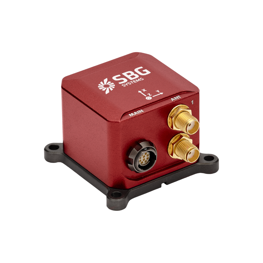
– SBG Ellipse-D RTK GNSS/INS with dual antenna GNSS with speed sensor
– Odometry for dead reckoning
– 2D LiDAR SLAM
– 3D LiDAR SLAM
When RTK GNSS/INS becomes smaller & cheaper
The Ellipse-D was an Inertial Navigation System integrating a dual antenna and dual frequency RTK GNSS that was also compatible with our Post-Processing software Qinertia.
As the whole Ellipse Series product line has recently been renewed, this solution is now replaced by the Ellipse-D 3rd Generation.
This new INS/GNSS conserves all its previous features a smaller size and weight package and embeds a powerful 64bit architecture allowing high-end filtering.
Power consumption has also been reduced. Designed for automobile applications, it can fuse Odometer input with Pulse or CAN OBDII for enhanced dead-reckoning accuracy.
Ellipse-D
The Ellipse-D is an inertial navigation system integrating a dual antenna and dual frequency RTK GNSS that is compatible with our Post-Processing software Qinertia.
Designed for robotic and geospatial applications, it can fuse Odometer input with Pulse or CAN OBDII for enhanced dead-reckoning accuracy.
Ask a quotation for Ellipse-D
Do you have questions?
Welcome to our FAQ section! Here, you’ll find answers to the most common questions about the applications we showcase. If you don’t find what you’re looking for, feel free to contact us directly!
What are the autonomy levels of autonomous vehicles?
The autonomy levels of autonomous vehicles are classified into six levels (Level 0 to Level 5) by the Society of Automotive Engineers (SAE), defining the extent of automation in vehicle operation. Here’s a breakdown:
- Level 0: No Automation – The human driver fully controls the vehicle at all times, with only passive systems like alerts and warnings.
- Level 1: Driver Assistance – The vehicle can assist with either steering or acceleration/deceleration, but the human driver must remain in control and monitor the environment (e.g., adaptive cruise control).
- Level 2: Partial Automation – The vehicle can control both steering and acceleration/deceleration simultaneously, but the driver must remain engaged and ready to take over at any moment (e.g., Tesla’s Autopilot, GM’s Super Cruise).
- Level 3: Conditional Automation – The vehicle can handle all aspects of driving in certain conditions, but the human driver must be ready to intervene when requested by the system (e.g., highway driving). The driver doesn’t need to actively monitor but must remain alert.
- Level 4: High Automation – The vehicle can perform all driving tasks autonomously within specific conditions or environments (like urban areas or highways) without human intervention. However, in other environments or under special circumstances, a human may need to drive.
- Level 5: Full Automation- The vehicle is fully autonomous and can handle all driving tasks in all conditions without any human intervention. There is no need for a driver, and the vehicle can operate anywhere, under any conditions.
These levels help define the evolution of autonomous vehicle technology, from basic driver assistance to full autonomy.
What is georeferencing in autonomous construction systems?
Georeferencing in autonomous construction systems refers to the process of aligning construction data, such as maps, models, or sensor measurements, with real-world geographic coordinates. This ensures that all data collected or generated by autonomous machines, such as drones, robots, or heavy equipment, is accurately positioned in a global coordinate system, like latitude, longitude, and elevation.
In the context of autonomous construction, georeferencing is critical for ensuring that machinery operates with precision across large construction sites. It allows for the accurate placement of structures, materials, and equipment by using satellite-based positioning technologies, such as GNSS (Global Navigation Satellite Systems), to tie the project to a real-world location.
Georeferencing enables tasks like excavation, grading, or material deposition to be automated and precisely controlled, improving efficiency, reducing errors, and ensuring that construction follows design specifications. It also facilitates progress tracking, quality control, and integration with Geographic Information Systems (GIS) and Building Information Modeling (BIM) for enhanced project management.
What is the difference between IMU and INS?
The difference between an Inertial Measurement Unit (IMU) and an Inertial Navigation System (INS) lies in their functionality and complexity.
An IMU (inertial measuring unit) provides raw data on the vehicle’s linear acceleration and angular velocity, measured by accelerometers and gyroscopes. It supplies information on roll, pitch, yaw, and motion, but does not compute position or navigation data. The IMU is specifically designed to relay essential data about movement and orientation for external processing to determine position or velocity.
On the other hand, an INS (inertial navigation system) combines IMU data with advanced algorithms to calculate a vehicle’s position, velocity, and orientation over time. It incorporates navigation algorithms like Kalman filtering for sensor fusion and integration. An INS supplies real-time navigation data, including position, velocity, and orientation, without relying on external positioning systems like GNSS.
This navigation system is typically utilized in applications that require comprehensive navigation solutions, particularly in GNSS-denied environments, such as military UAVs, ships, and submarines.
What is GNSS vs GPS?
GNSS stands for Global Navigation Satellite System and GPS for Global Positioning System. These terms are often used interchangeably, but they refer to different concepts within satellite-based navigation systems.
GNSS is a collective term for all satellite navigation systems, while GPS refers specifically to the U.S. system. It includes multiple systems that provide more comprehensive global coverage, while GPS is just one of those systems.
You get improved accuracy and reliability with GNSS, by integrating data from multiple systems, whereas GPS alone might have limitations depending on satellite availability and environmental conditions.
