Navsight Land-Air Motion & navigation for surveying applications
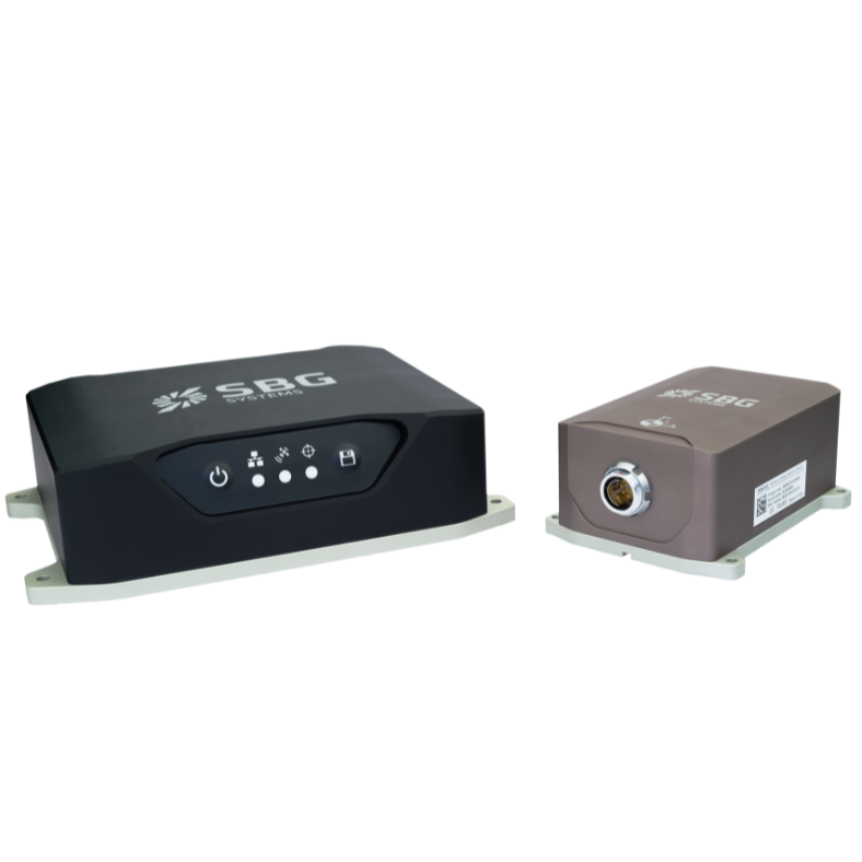
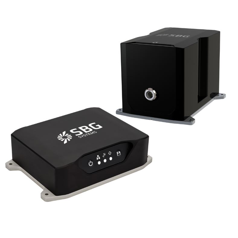
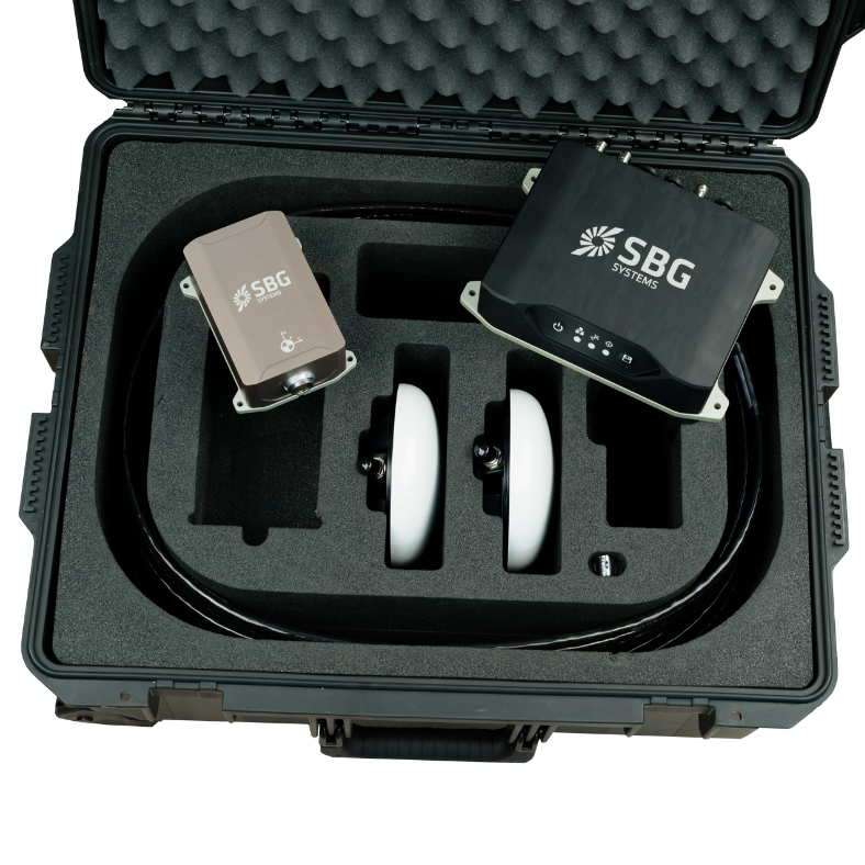
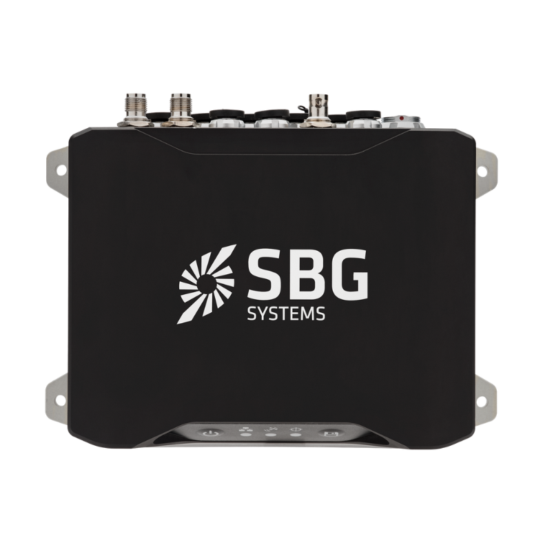
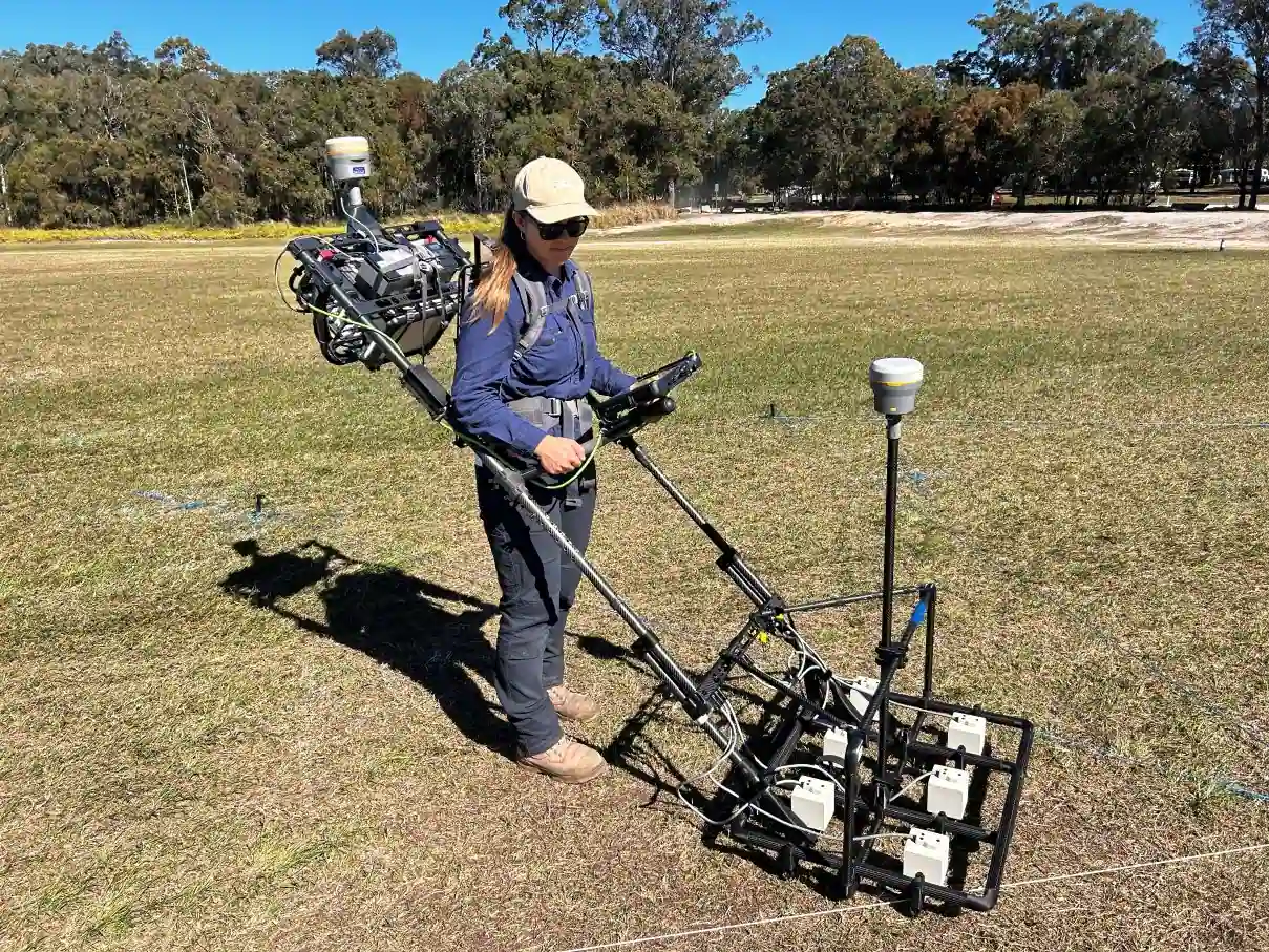
Navsight Land-Air is a full high performance inertial navigation solution designed to make surveyors’ mobile data collection easier, whether it is terrestrial or aerial. It is an extremely versatile solution, made of an Inertial Measurement Unit available at three different performance levels, and connected to Navsight box, a rugged equipment embedding the fusion intelligence, the GNSS receiver, and all connections to external equipment such as LiDAR, cameras, computer, etc.
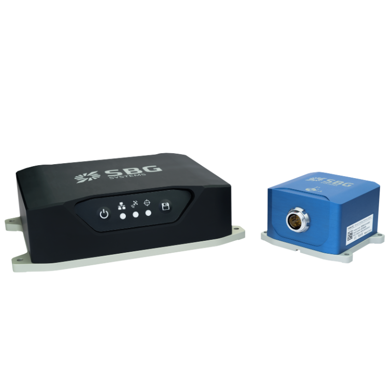
Navsight solution is composed of various components that can be adjusted or configured according to your specific application needs. The IMU is the main sensing element and the most important performance driving factor. In case of good GNSS conditions and entry-level land-air survey, users can select the Ekinox IMU. For more challenging conditions, such as difficult GNSS environments or high altitude, the Apogee grade is the sensor of choice to maintain the best accuracy. For ultimate accuracy, the Horizon IMU is the optimal choice.
Discover all Navsight Land-Air features and applications.
Navsight Land-Air features
Navsight is a comprehensive inertial navigation solution, specifically designed for the survey markets. Leveraging on existing SBG Systems inertial sensors, exclusive advanced algorithms and high performance GNSS technology, it also adds an incredibly easy to use setup.
The Navsight processing unit can be connected to a wide range of aiding sensors such as GNSS, DVL, Odometer.
Get scalable performance for every application with our Marine solution. By choosing the Ekinox IMU grade you get a low power consumption, economical, compact and lightweight version, ideal for mobile mapping, autonomous vehicles, and tactical operations. With our highly versatile Apogee IMU grade solution, you will obtain an amazing performance under GNSS Outage, ideal for applications requiring reliable navigation and orientation data in harsh, GNSS-denied conditions.
Last but not least, our Horizon IMU grade version is the highest performance available in Navsight Series. Leveraging on a closed loop Fiber Optic Gyroscopes technology (FOG Technology), this IMU is the unit of choice for most difficult conditions such as high-altitude survey or single antenna airborne applications and harsh automotive environments. The ultra low gyro bias enable optimal performance on large vessels with low dynamics with very low drift.
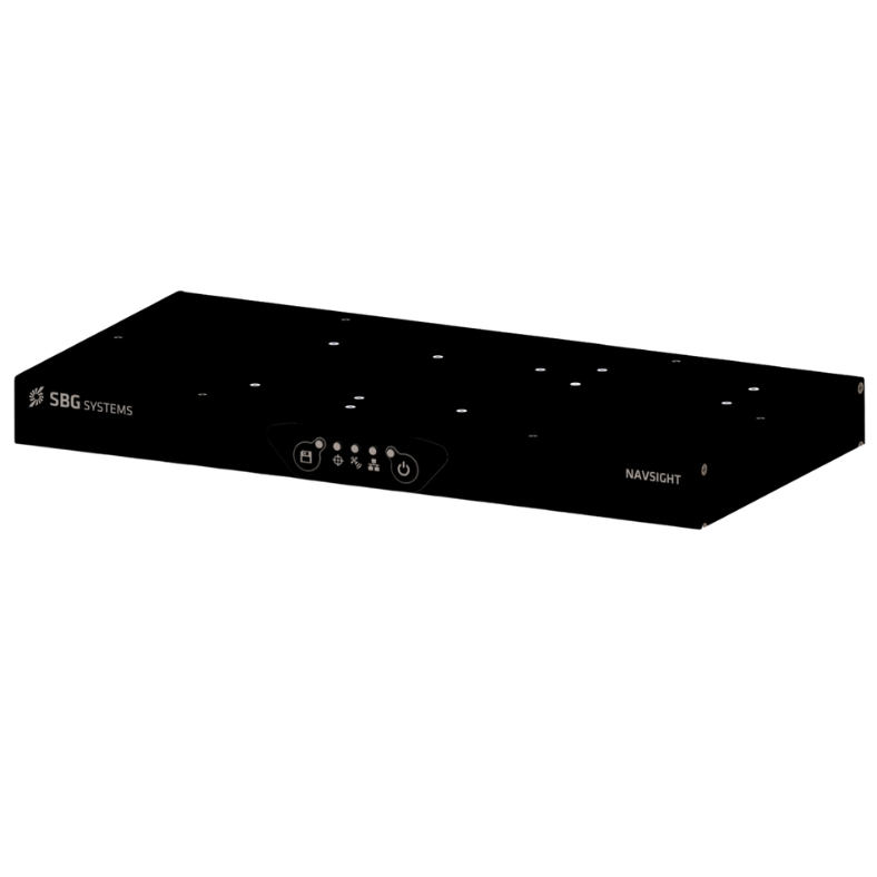
The rack version of Navsight processing unit is also available and it’s well suited for integration into a standard 19” rack setup. In addition, the use of standard connectors such as RJ-45 and DB-9 enable fast integration.
Explore Navsight Land-Air’s exceptional features and specifications.


Applications
Surveying applications require precise data collection across diverse and challenging terrains, from dense urban areas to rugged, open landscapes and high altitudes. These environments often present GNSS signal obstructions and multipath issues due to structures like buildings, foliage, and mountains. Additionally, airborne surveys demand navigation stability and data integrity at varying altitudes and in dynamic atmospheric conditions, which can impact accuracy.
SBG Systems’ Navsight Land-Air Solution addresses these complexities with a robust, adaptable platform suited for both land and aerial survey missions.
Our Navsight solution delivers consistent accuracy by combining high-performance inertial measurement with advanced GNSS technology and sensor fusion, even when GNSS signals are interrupted. Its modular IMU options allow surveyors to select the ideal grade for their specific needs, ensuring optimal performance in various conditions. With Navsight Land-Air, surveyors achieve reliable, high-precision data collection, streamlining mapping, infrastructure planning, and geospatial data acquisition.
Discover the full range of Navsight Land-Air applications.
Our case studies
Explore real-world use cases demonstrating how our Navsight Marine enhance performance, reduce downtime, and improve operational efficiency. Learn how our advanced sensors and intuitive interfaces provide the precision and control you need to excel in your applications.


Our differents versions
Compare our most advanced inertial range of sensors for navigation, motion, and heave sensing. You can find the full specifications, available upon request.
| RTK horizontal position | RTK horizontal position 0.015 m + 1 ppm | RTK horizontal position 0.01 m + 0.5 ppm | RTK horizontal position 0.01 m + 0.5 ppm |
|---|---|---|---|
| RTK roll/pitch | RTK roll/pitch 0.015 ° | RTK roll/pitch 0.008 ° | RTK roll/pitch 0.007 ° |
| RTK heading | RTK heading 0.04 ° | RTK heading 0.02 ° | RTK heading 0.01 ° |
| GNSS receiver | GNSS receiver Dual antenna | GNSS receiver Dual antenna | GNSS receiver Dual antenna |
| Weight (g) | Weight (g) 1 990 g | Weight (g) 1 990 g | Weight (g) 1 990 g |
| Dimensions (LxWxH) | Dimensions (LxWxH) 227 x 156 x 63 mm | Dimensions (LxWxH) 227 x 156 x 63 mm | Dimensions (LxWxH) 227 x 156 x 63 mm |
Compatibility
Documentation & resources
Navsight Land-Air comes with comprehensive documentation, designed to support users at every step.
From installation guides to advanced configuration and troubleshooting, our clear and detailed online documentation ensure smooth integration and operation.
Additional products & accessories
Discover how our solutions can transform your operations by exploring our diverse range of applications. With our Motion and Navigation sensors and software, you gain access to state-of-the-art technologies that drive success and innovation in your field.
Join us in unlocking the potential of inertial navigation and positioning solutions across various industries.
Qinertia GNSS-INS
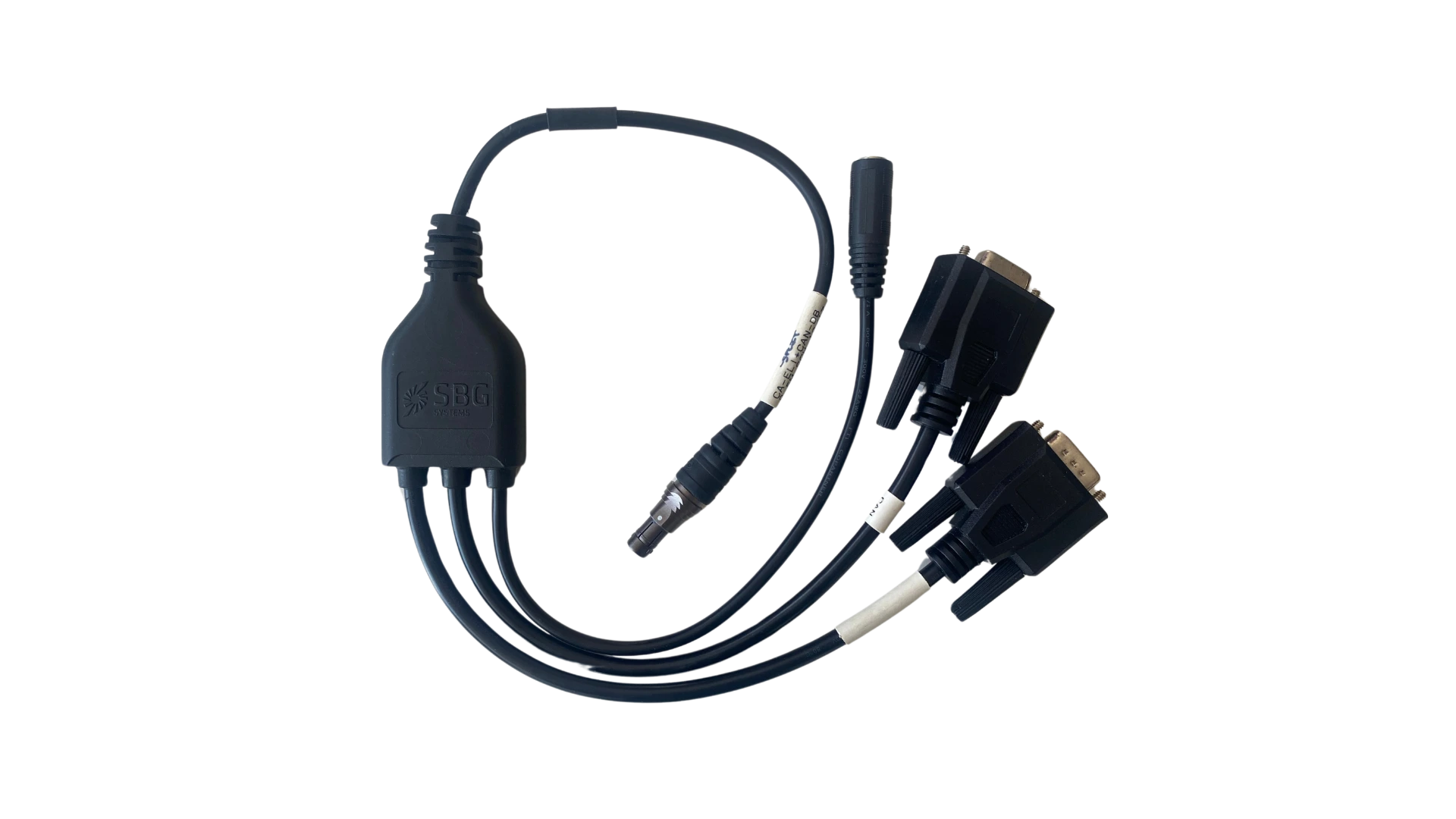
Cables
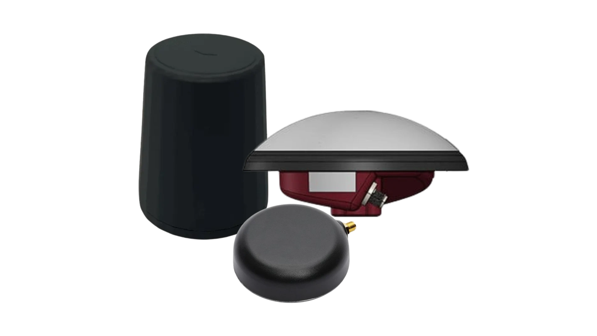
GNSS Antennas
Our production process
Discover the precision and expertise behind every SBG Systems products. This following video offers an inside look at how we meticulously design, manufacture, calibrate and test our high-performance inertial navigation systems. From advanced engineering to rigorous quality control, our production process ensures that each product meets the highest standards of reliability and accuracy. Whether you’re curious about the technology or interested in seeing how we bring innovative solutions to life, this video highlights our commitment to excellence in every step of the production process.

Ask for a quotation
They talk about us
Find about the experiences and testimonials from industry professionals and clients who have leveraged the Navsight solution in their projects. Their insights reflect the quality and performance that define the Navsight Marine, emphasizing its role as a trusted solution in the field.
Discover how our innovative technology has transformed their operations, enhanced productivity, and delivered reliable results across various applications.
Do you have questions?
Welcome to our FAQ section, where we address your most pressing questions about our cutting-edge technology and its applications. Here, you’ll find comprehensive answers regarding product features, installation processes, troubleshooting tips, and best practices to maximize your experience with Navsight Series.
Find Your Answers Here !
Does INS accept inputs from external aiding sensors?
Inertial Navigation Systems from our company accept inputs from external aiding sensors, such as air data sensors, magnetometers, Odometers, DVL and other.
This integration makes the INS highly versatile and reliable, especially in GNSS-denied environments.
These external sensors enhance the overall performance and accuracy of the INS by providing complementary data.
What is the difference between IMU and INS?
The difference between an Inertial Measurement Unit (IMU) and an Inertial Navigation System (INS) lies in their functionality and complexity.
An IMU (inertial measuring unit) provides raw data on the vehicle’s linear acceleration and angular velocity, measured by accelerometers and gyroscopes. It supplies information on roll, pitch, yaw, and motion, but does not compute position or navigation data. The IMU is specifically designed to relay essential data about movement and orientation for external processing to determine position or velocity.
On the other hand, an INS (inertial navigation system) combines IMU data with advanced algorithms to calculate a vehicle’s position, velocity, and orientation over time. It incorporates navigation algorithms like Kalman filtering for sensor fusion and integration. An INS supplies real-time navigation data, including position, velocity, and orientation, without relying on external positioning systems like GNSS.
This navigation system is typically utilized in applications that require comprehensive navigation solutions, particularly in GNSS-denied environments, such as military UAVs, ships, and submarines.
what is the physical differences between Navsight Land-Air and Navsight Marine ?
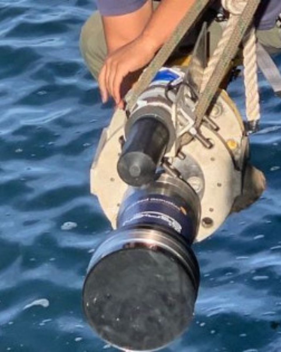
The Navsight Land/Air and Navsight Marine systems from SBG Systems are physically designed to meet the specific demands of their respective environments. The Navsight Land/Air features a compact, lightweight aluminum enclosure ideal for integration on UAVs and land vehicles, where size and weight are critical. It includes industrial or aviation-style connectors and is built to withstand rugged conditions, though it is not fully waterproof. This version is designed for environments where airflow helps with cooling and where exposure to water is limited.
In contrast, the Navsight Marine is engineered for operation in harsh marine environments. It features a robust, fully sealed IP68-rated enclosure made from corrosion-resistant materials, making it suitable for long-term exposure to water, salt, and humidity. The system is equipped with waterproof marine-grade connectors and is designed for secure installation on vessels, with enhanced vibration damping and passive cooling that does not rely on airflow. These physical differences ensure that each version of Navsight performs reliably and efficiently in its intended application domain.
