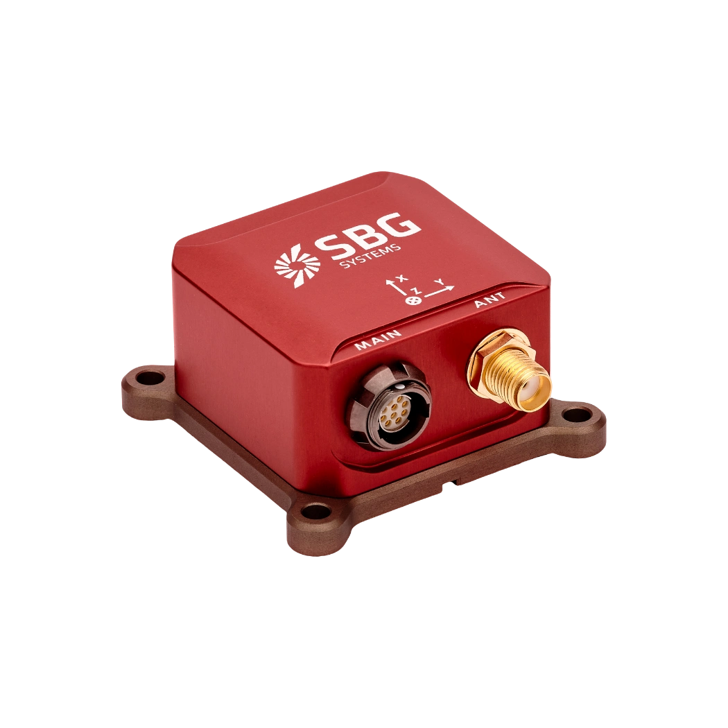
High-precision accelerometers and gyroscopes
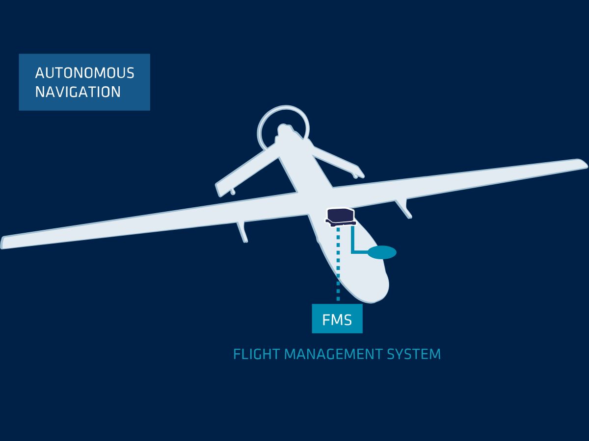
Inertial Systems play a critical role as both primary and secondary navigation aids in defense devices and vehicles (e.g. unmanned aerial vehicles), working alongside GNSS, magnetometers, air data, and other aiding sensors. These systems provide continuous, real-time navigation data essential for collision avoidance, path planning, and situational awareness. Additionally, INS enhances vehicle autonomy, enabling vehicles to operate more independently on the battlefield.
Our individually calibrated inertial systems with advanced MEMS technology accelerometers and gyroscopes bring exceptional resilience and reliability to a PNT solution. By combining data from these sensors through sophisticated multi-sensor fusion algorithms, high-accuracy INS solutions can detect movement changes while providing jamming and spoofing mitigation through adaptive notch filtering, and RAIM.
This sensor fusion enables precise navigation data with dead reckoning drift error limited to 0.5% to 2% of the distance traveled over extended periods.
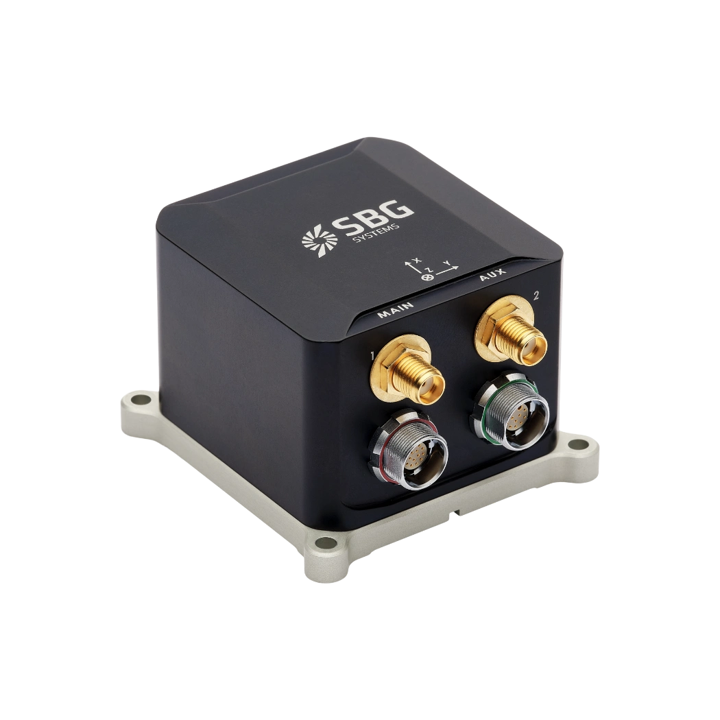
Robust & space-efficient design
Our navigation systems are MEMS-based inertial measurement units (IMU) available in both rugged MIL-STD and compact OEM form factors. Designed and manufactured in France, we use materials robust enough to endure extreme military conditions such as shocks, intense vibrations, drastic temperature changes, and harsh climates.
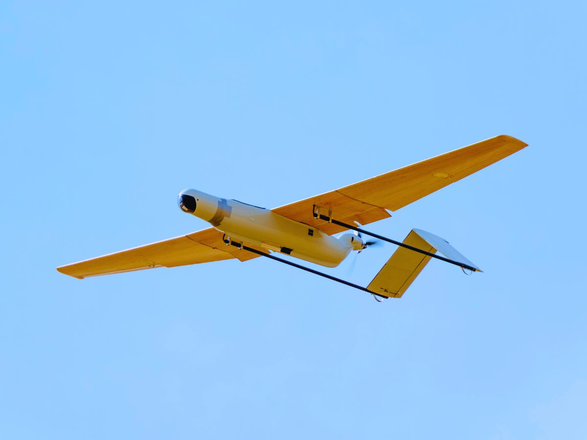
Our incredible size, weight, and performance ratio makes them ideal for UAVs and loitering munitions where payload constraints are critical.
Reliability in these environments is crucial, as system failure could compromise mission success. Tested against military standards (MIL-STD 810), these materials ensure critical systems continue functioning optimally while providing frequency analysis alerts and sensor hybridization circumvention capabilities for enhanced electronic warfare resilience.

Easy to integrate OEM and boxed solutions
Our inertial sensors seamlessly integrate into all types of UAVs through flexible APIs including Binary, NMEA, and RESTful interfaces. Direct compatibility with popular autopilot systems like Pixhawk and Ardupilot allows our INS to be easily installed without requiring significant adaptations and limited effort.
This adaptability ensures quick implementation through multiple integration options, reducing downtime and operational costs while maintaining navigation accuracy. With our scalable solutions, defense forces can ensure their entire fleet benefits from enhanced navigation capabilities, supporting mission-critical operations without disrupting UAV configurations or requiring complex retrofits.
Our worldwide network of 70 distributors ensures global support for defense applications.
Solutions for UAV navigation
Our sensors provide an extremely low latency between motion and output. They are carefully designed with signal conditioning and FIR filtering to deliver high bandwidth while protecting the measurement from vibrations.
Stellar-40

Ellipse-D
Ellipse-E
Ellipse-N
Ekinox Micro

Quanta Plus

Quanta Extra
Defense applications brochure
Get our brochure delivered straight to your inbox!
Case studies
Explore the success stories behind SBG Systems’ UAV inertial solutions. Discover how our cutting-edge navigation systems have transformed unmanned aerial vehicles operations across various industries, from precision agriculture to defense.
Each case study highlights real-world applications where our advanced inertial sensors and GNSS technology have delivered unmatched accuracy, reliability, and performance.


They talk about us
Discover how our inertial solutions have elevated our customers operations, and enhanced their productivity.
Discover other defense applications for autonomous vehicles
Explore how inertial navigation systems enhance the performance of autonomous vehicles in a wide range of defense applications. From unmanned ground systems to autonomous convoys and reconnaissance platforms, our solutions provide the precise positioning, orientation, and reliability required for mission success—even in GNSS-denied environments.
Do you have questions?
Welcome to our FAQ section! Here, you’ll find answers to the most common questions about UAV-unmanned aerial vehicles navigation. If you don’t find what you’re looking for, feel free to contact us directly!
What kinds of INS integration are possible within defense UAVs?
Our solutions are well-suited for integration with various types of defense UAVs, offering versatility and adaptability for different operational needs. Our motion and navigation sensors bring tactical sensing to your systems without compromise on SWaP-C! They are particularly suited to use by integrators.
For UAVs that rely on GNSS, our dual-antenna GNSS receivers offer exceptional accuracy. This is beneficial for surface navigation and aids in transitioning between aerial and ground navigation. Additionally, all sensors support various communication protocols such as RS-232, CAN, and Ethernet, allowing seamless integration with UAV systems.
Finally, it is possible to integrate external positioning solutions such as DVL, or other navigation aids to provide accurate roll, pitch, heading, and altitude data. This enhances navigation in environments where GNSS signals might be weak or unavailable.
How do we ensure sensor quality standards for UAV military applications?
At SBG Systems, ensuring the highest quality standards for our inertial measurement units (IMUs) involves a meticulous process. We begin with the optimal selection of high-end MEMS components, focusing on reliable accelerometers and gyroscopes that meet our stringent quality requirements. Our IMUs are housed in robust casings designed to withstand vibrations and environmental conditions, guaranteeing durability and performance.
Our automated calibration process involves a 2-axis table and addresses temperature ranges from -40°C to 85°C. This calibration compensates for various factors including biases, cross-axis effects, misalignment, scale factors, and non-linearities in accelerometers and gyroscopes, ensuring consistent performance in all weather conditions.
Our qualification process further involves strict in-house screening to ensure that only sensors meeting our specifications continue through production. Each IMU is accompanied by a detailed calibration report and is guaranteed for two years. This rigorous approach ensures high quality, reliability, and consistent performance over time, delivering superior IMUs for defense and other critical applications.
We also conducts thorough environmental and endurance testing to ensure reliability. Some of our sensors meet several MIL-STD standards, guaranteeing resistance to shock, vibration, and extreme conditions.
How to control output delays in UAV operations?
Controlling output delays in UAV operations is essential for ensuring responsive performance, precise navigation, and effective communication, especially in defense or mission-critical applications.
The output latency is an important aspect in real time control applications, where a higher output latency could degrade control loops performance. Our INS embedded software has been designed to minimize output latency: once sensor data are sampled, the Extended Kalman Filter (EKF) performs small and constant-time computations before the outputs are generated. Typically the observed output delay is less than one millisecond.
The processing latency should be added to the data transmission latency if you want to get total delay. This transmission latency vary from one interface to another. For instance, a 50 bytes message sent on a UART interface at 115200 bps will take 4ms for complete transmission. Consider higher baudrates to minimize output latency.
What is PNT?
PNT stands for Positioning, Navigation, and Timing — the three foundational pillars that enable any modern navigation or coordination system, whether in aerospace, defense, maritime, autonomous vehicles, or critical infrastructure.
Here’s a clear breakdown:
1. Positioning
This answers the question: “Where am I?”
It provides precise geographic coordinates (latitude, longitude, altitude). Typically derived from GNSS (GPS, Galileo, GLONASS, BeiDou) or INS when GNSS is unavailable.
Essential for tracking, guidance, mapping, and situational awareness.
2. Navigation
This answers: “How do I move from A to B?”
It involves determining direction, speed, and trajectory to reach a destination safely and efficiently. Includes velocity, course, and attitude (roll, pitch, yaw).
Often achieved using IMUs/INS, sensor fusion algorithms, odometry, or GNSS-based navigation.
3. Timing
This answers: “What time is it, precisely?”
Accurate, synchronized time is critical for the coordination of systems and signals. High-precision timing underpins communication networks, military systems, power grids, and GNSS itself.
Even microsecond-level errors can cause failures in comms, data links, or geolocation.
Why PNT Matters ?
PNT is at the core of every modern autonomous or guided system—whether missiles, UAVs, vehicles, USVs, AUVs, or even cellphone networks. When GNSS is degraded or denied, inertial systems (IMU/INS) become the backbone of resilient PNT.
What is an Inertial Measurement Unit?
Inertial Measurement Units (IMUs) are sophisticated devices that measure and report a body’s specific force, angular velocity, and sometimes magnetic field orientation. IMUs are crucial components in various applications, including navigation, robotics, and motion tracking. Here’s a closer look at their key features and functions:
- Accelerometers: Measure linear acceleration along one or more axes. They provide data about how quickly an object is speeding up or slowing down and can detect changes in motion or position.
- Gyroscopes: Measure angular velocity, or the rate of rotation around a specific axis. Gyroscopes help determine orientation changes, enabling devices to maintain their position relative to a reference frame.
- Magnetometers (optional): Some IMUs include magnetometers, which measure the strength and direction of magnetic fields. This data can help determine the device’s orientation relative to the Earth’s magnetic field, enhancing navigational accuracy.
IMUs provide continuous data on an object’s motion, allowing for real-time tracking of its position and orientation. This information is critical for applications like drones, vehicles, and robotics.
In applications such as camera gimbals or UAVs, IMUs help stabilize movements by compensating for unwanted motions or vibrations, resulting in smoother operations.
What is dead reckoning in aviation ?
Dead reckoning in aviation is a traditional navigation method that estimates an aircraft’s current position by projecting its last known location forward using measured or assumed parameters such as heading, airspeed, time, and environmental factors like wind.
Instead of relying on external references—such as radio beacons, GNSS satellites, or visual landmarks—dead reckoning uses the aircraft’s own motion information to compute where it should be now relative to where it started. The pilot or onboard navigation system begins with a known fix, then applies the aircraft’s true heading and true airspeed over a given time interval to calculate a new estimated position.
However, because the aircraft is moving through an air mass affected by wind, the computation must incorporate wind direction and velocity; otherwise, the calculated track will deviate from the actual path flown.
In modern aviation, inertial navigation systems enhance dead reckoning by using accelerometers and gyroscopes to measure linear accelerations and rotation rates, continuously integrating these measurements to estimate velocity, attitude, and position. While this inertial dead reckoning dramatically improves independence from external signals, it still accumulates errors over time due to sensor biases and noise. For this reason, INS-based dead reckoning is often paired with GNSS or other aiding sources to bound drift and maintain long-term accuracy.
Despite these limitations, dead reckoning remains essential for ensuring continuity of navigation during GNSS outages, radio-silence missions, or operations in environments where external references are unreliable or denied.
