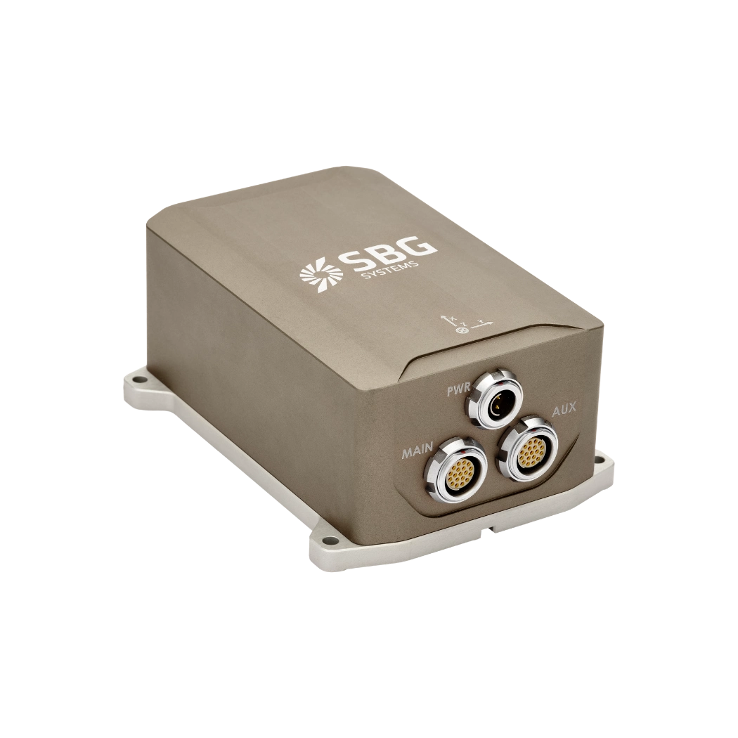
MRU – Motion Reference Unit

Motion Reference Unit (MRU) is a sensor system designed to measure and report the dynamic movements of an object, particularly in marine and aerospace environments. These units provide data on roll, pitch, and heave motions, which are crucial for navigation, stabilization, and operational efficiency. MRUs utilize advanced sensor technologies to deliver high-precision motion data in real-time.
These devices find application in various vessels, including ships and aircraft, as well as industrial platforms, where they contribute to the maintenance of operational safety under conditions of constant motion.
An MRU is sometimes referred to as an Attitude & Heading Reference System (AHRS) or Vertical Reference Unit (VRU) , but they serve different purposes. An AHRS provides full 3D orientation, including heading, and engineers frequently use it for navigation. A Motion Reference Unit focuses on motion dynamics, especially vertical motion such as heave. Operators often use it for marine stabilization and motion compensation.
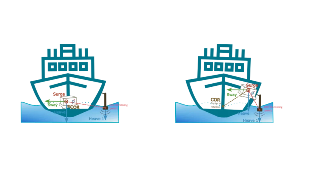
To optimize heave performance:
- Place the sensor near the center of rotation and clearly define the point of interest, such as mounting it directly on top of the MBES sonar using a “Monitoring Point”. Note that only heave measurements can be transferred; surge and sway must remain measured at the IMU.
- Alternatively, position the sensor in a more accessible location or closer to the point of interest. Then properly configure the Main Lever Arm (COR) and the monitoring point.
Technologies behind MRUs
The fundamental component of an MRU is the Inertial Measurement Unit (IMU), which comprises gyroscopes and accelerometers. Gyroscopes are instruments that detect rotation around different axes and provide precise angular velocity data.
High-end MRUs frequently utilise fibre optic or ring laser gyroscopes to ensure optimal stability and precision.Accelerometers are capable of measuring linear acceleration, thereby enabling the tracking of motion along the X, Y, and Z axes. The majority of MRUs also incorporate GNSS technology with a view to enhancing positional accuracy and stability.
RTK and differential GNSS corrections further refine motion tracking by reducing signal errors. The utilisation of advanced data fusion algorithms by a motion reference unit is pivotal in the consolidation of sensor inputs into a unified, coherent output. Kalman filters remove noise and improve measurement accuracy across all motion parameters.
Sensor fusion algorithms combine gyroscope, accelerometer, and GNSS data to ensure more reliable motion tracking.
Applications of motion reference units
In marine applications, a motion reference unit helps stabilize ships and improve dynamic positioning systems. Furthermore, they assist in the rectification of vessel motion during hydrographic surveys, thereby enhancing the precision of seabed mapping. In the field of aerospace engineering, MRUs play a pivotal role in the control of UAVs, the stability of aircraft, and the management of satellite orientation.
The offshore and subsea industries utilise MRUs to guide ROVs and stabilise drilling platforms. In the domain of civil engineering, MRUs play a pivotal role in the monitoring of structural movement and the guidance of precision equipment on dynamic sites. These units function in a continuous manner, thereby providing data that supports safety, accuracy, and efficient operation. As technology advances, MRUs or VRUs will continue to evolve in order to meet the increasing demand for precise motion data.
If you have a project in mind that involves Motion Reference Unit solutions, please get in touch with our experts.
Do you have questions?
What is the difference between IMU and INS?
The difference between an Inertial Measurement Unit (IMU) and an Inertial Navigation System (INS) lies in their functionality and complexity.
An IMU (inertial measuring unit) provides raw data on the vehicle’s linear acceleration and angular velocity, measured by accelerometers and gyroscopes. It supplies information on roll, pitch, yaw, and motion, but does not compute position or navigation data. The IMU is specifically designed to relay essential data about movement and orientation for external processing to determine position or velocity.
On the other hand, an INS (inertial navigation system) combines IMU data with advanced algorithms to calculate a vehicle’s position, velocity, and orientation over time. It incorporates navigation algorithms like Kalman filtering for sensor fusion and integration. An INS supplies real-time navigation data, including position, velocity, and orientation, without relying on external positioning systems like GNSS.
This navigation system is typically utilized in applications that require comprehensive navigation solutions, particularly in GNSS-denied environments, such as military UAVs, ships, and submarines.
What is AHRS ?
AHRS or Attitude and Heading Reference Systems, is an integrated navigation subsystem that provides a real-time, drift-controlled estimate of a platform’s orientation—its roll, pitch, and heading. At its core, an AHRS fuses measurements from three types of sensors: gyroscopes, accelerometers, and magnetometers.
Gyroscopes track angular rates, accelerometers sense specific forces including gravity, and magnetometers measure the Earth’s magnetic field to reference heading. On their own, each sensor has limitations—gyros drift over time, accelerometers are influenced by dynamic motion, and magnetometers can be disturbed by nearby ferrous objects—but when combined through advanced filtering algorithms such as extended or nonlinear Kalman filters, the system produces a stable, accurate, and continuous attitude solution.
Modern AHRS units also incorporate calibration models to compensate for temperature variations, misalignment, scale-factor errors, and magnetic distortions, significantly improving robustness. Compared to simple IMUs, which only deliver raw sensor outputs, an AHRS provides a fully computed, ready-to-use orientation output.
Unlike a full navigation-grade INS, however, it typically does not integrate velocity or position unless coupled with additional sensors. AHRS solutions are widely used in UAVs, USVs, UGVs, aircraft, marine vessels, and many defense platforms where reliable attitude and heading information is crucial for control, stabilization, and situational awareness—even in environments where GPS may be unavailable or degraded.
What is the difference between AHRS and INS?
The main difference between an Attitude and Heading Reference System (AHRS) and an Inertial Navigation System (INS) lies in their functionality and the scope of the data they provide.
AHRS provides orientation information—specifically, the attitude (pitch, roll) and heading (yaw) of a vehicle or device. It typically uses a combination of sensors, including gyroscopes, accelerometers, and magnetometers, to calculate and stabilize the orientation. The AHRS outputs the angular position in three axes (pitch, roll, and yaw), allowing a system to understand its orientation in space. It is often used in aviation, UAVs, robotics, and marine systems to provide accurate attitude and heading data, which is critical for vehicle control and stabilization.
A INS not only provides orientation data (like an AHRS) but also tracks a vehicle’s position, velocity, and acceleration over time. It uses inertial sensors to estimate movement in 3D space without relying on external references like GNSS. It combines the sensors found in AHRS (gyroscopes, accelerometers) but may also include more advanced algorithms for position and velocity tracking, often integrating with external data like GNSS for enhanced accuracy.
In summary, AHRS focuses on orientation (attitude and heading), while INS provides a full suite of navigational data, including position, velocity, and orientation.