USV-based bathymetry
Ekinox-D, the Perfect INS for USV-based Bathymetry.
“We were looking for a compact, precise and cost-effective inertial navigation system. The Ekinox-D was the perfect match.” | David M., CEO of ITER Systems
Ekinox-D, the perfect INS for USV-based bathymetry
Like most unmanned systems, USVs face space and power constraints. Furthermore, Ekinox-D is the best INS for integration into such vehicles.
Weighing less than 600 grams and consuming under 7W, Ekinox-D includes an RTK dual antenna GNSS receiver for centimeter-level positioning. In addition, it provides 0.05° attitude accuracy and delivers 5 cm real-time heave that adapts automatically to wave periods.
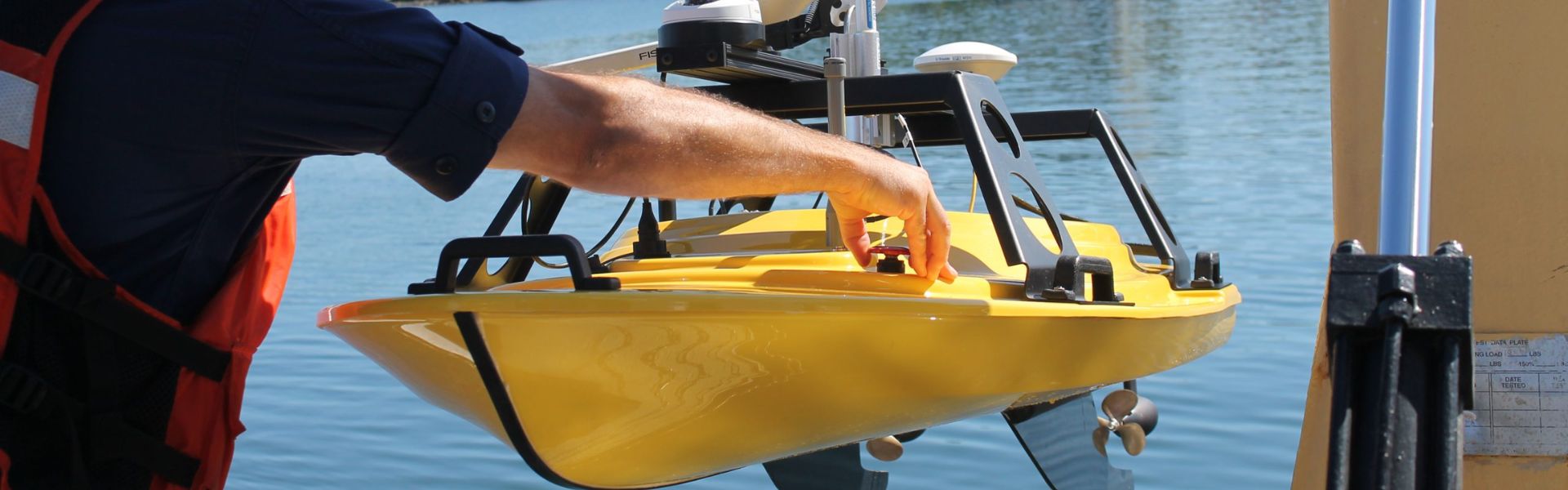
USV with Swath Bathymetry Sonar
SPYBOAT® Swan is an Unmanned Surface Vessel (USV) fully equipped for shallow-water hydrographic operations. Moreover, an operator remotely controls it from shore, up to one kilometer away. Swan performs bathymetric surveys in areas inaccessible to vessels, such as riverbeds, lakes, reservoirs, dams, or harbors. In addition, it ensures accurate mapping in challenging environments.
Equipped with a Bathyswath 2, a swath bathymetry sonar, the USV provides bathymetric and navigation information in real-time to the operator’s tablet PC. Swan is compatible with all hydrographic software.
“Ekinox-D perfect fit to Survey-based USV operating in shallow waters”. | ITER Systems
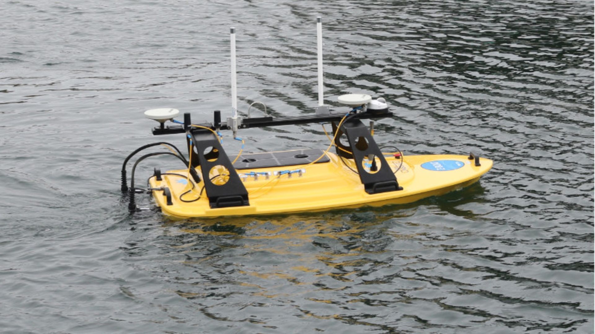
USV with Multibeam Echosounder
The Oceanscience Z-Boat is designed with the surveyor in mind.
The hull shape, propulsion, radio communication, and on demand sonar instrumentation combine to offer an easy to use and powerful option for the hydrographic surveyor or land surveyor wishing to complete inshore hydrographic work.
The custom integration for the University of Washington Tacoma delivered in May, 2016 included the Rugged Z-Boat 1800RP, SBG Systems’ Ekinox-D Inertial Navigation System, Teledyne Odom Hydrographic MB2 Multibeam, Teledyne RD Instruments RiverPro ADCP, a camera and onboard computer.

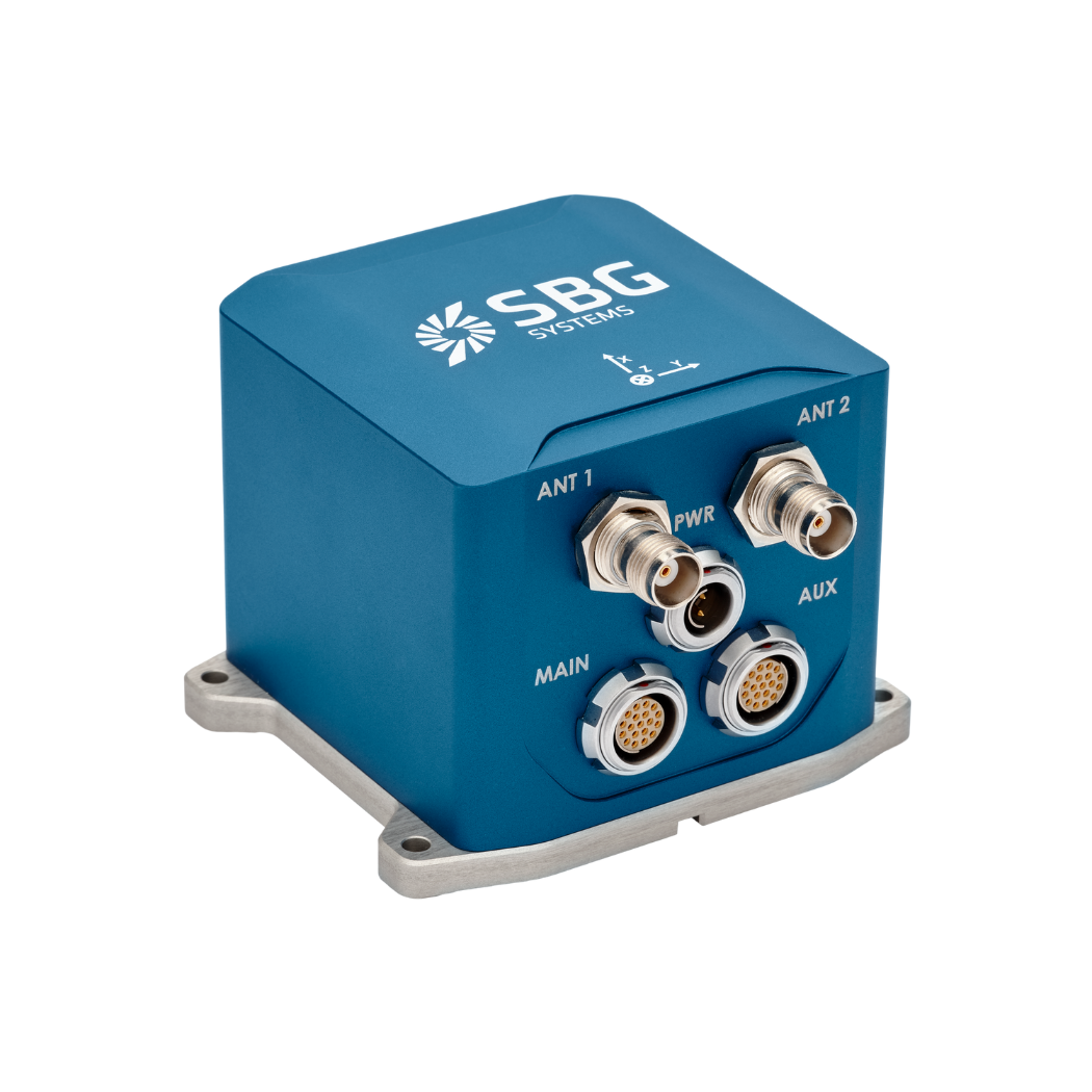
Ekinox-D
Ekinox-D is an all-in-one Inertial Navigation System with integrated RTK GNSS receiver ideal for applications where space is critical.
This advanced INS/GNSS comes with one or two antennas and provides orientation, heave, and centimeter-level position.
Ask a quotation for Ekinox-D
Do you have questions?
Welcome to our FAQ section! Here, you will find answers to common questions about our showcased applications. Moreover, if you don’t find what you need, please contact us directly.
How can I combine inertial systems with a LIDAR for drone mapping?
Combining SBG Systems’ inertial systems with LiDAR for drone mapping enhances accuracy and reliability in capturing precise geospatial data.
Here’s how the integration works and how it benefits drone-based mapping:
- A remote sensing method that uses laser pulses to measure distances to the Earth’s surface, creating a detailed 3D map of the terrain or structures.
- SBG Systems INS combines an Inertial Measurement Unit (IMU) with GNSS data to provide accurate positioning, orientation (pitch, roll, yaw), and velocity, even in GNSS-denied environments.
SBG’s inertial system is synchronized with the LiDAR data. The INS accurately tracks the drone’s position and orientation, while the LiDAR captures the terrain or object details below.
By knowing the precise orientation of the drone, the LiDAR data can be accurately positioned in 3D space.
The GNSS component provides global positioning, while the IMU offers real-time orientation and movement data. The combination ensures that even when the GNSS signal is weak or unavailable (e.g., near tall buildings or dense forests), the INS can continue to track the drone’s path and position, allowing for consistent LiDAR mapping.
What is Multibeam Echo Sounding?
Multibeam Echo Sounding (MBES) is an advanced hydrographic surveying technique used to map the seafloor and underwater features with high precision.
Unlike traditional single-beam echo sounders that measure depth at a single point directly beneath the vessel, MBES utilizes an array of sonar beams to simultaneously capture depth measurements across a wide swath of the seafloor. This allows for detailed, high-resolution mapping of underwater terrain, including topography, geological features, and potential hazards.
MBES systems emit sound waves that travel through the water, bouncing off the seafloor and returning to the vessel. By analyzing the time it takes for the echoes to return, the system calculates the depth at multiple points, creating a comprehensive map of the underwater landscape.
This technology is essential for various applications, including navigation, marine construction, environmental monitoring, and resource exploration, providing critical data for safe maritime operations and sustainable management of marine resources.
What is the difference between RTK and PPK?
Real-Time Kinematic (RTK) is a positioning technique where GNSS corrections are transmitted in near real time, typically using an RTCM format correction stream. However, there can be challenges in ensuring the GNSS corrections, specifically their completeness, availability, coverage, and compatibility.
The major advantage of PPK over RTK post processing is that the data processing activities can be optimized during post-processing, including forward and backward processing, whereas in real-time processing, any interruption or incompatibility in the corrections and their transmission will lead to lower accuracy positioning.
A first key advantage of GNSS post-processing (PPK) vs. real time (RTK) is that the system used on the field does not need to have a datalink/radio to feed the RTCM corrections coming from the CORS into the INS/GNSS system.
The main limitation to post processing adoption is the requirement of the final application to act on the environment. On the other hand, if your application can withstand the additional processing time needed to produce an optimized trajectory, it will greatly improve the data quality for all your deliverables.
