Case studies – Page 4
Discover how our innovative inertial technology solutions are making a difference in real-world applications. Our case studies showcase practical examples of how we’ve tackled complex challenges, delivering precise navigation, motion tracking, and advanced performance across a range of industries.


Discover our applications
Each case highlights the unique challenges our clients faced, the solutions we tailored together, and the successful outcomes achieved. These case studies demonstrate the potential of inertial technology to transform projects into reality.
Cadden
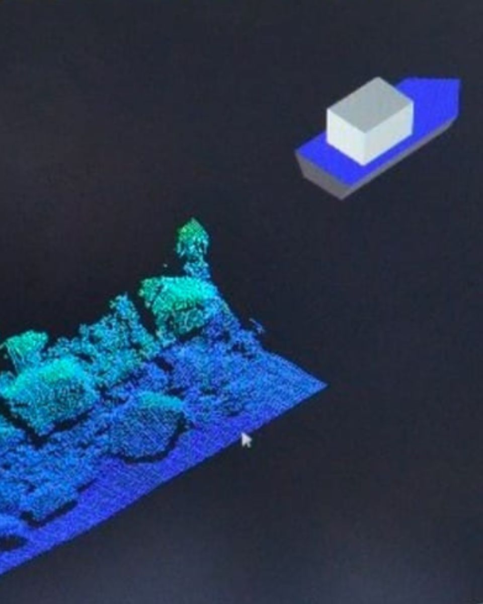
ASV solution integrating SBG’s INS and Multibeam Echosounder
ASV – Autonomous Surface Vehicles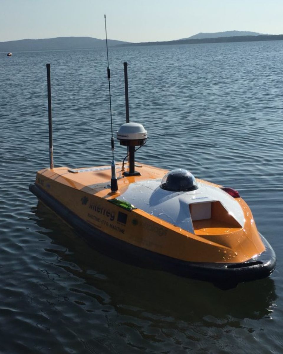
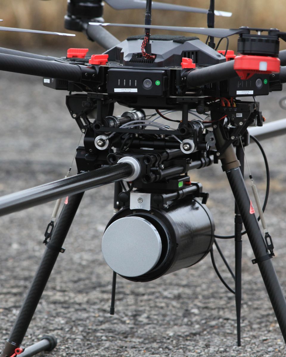
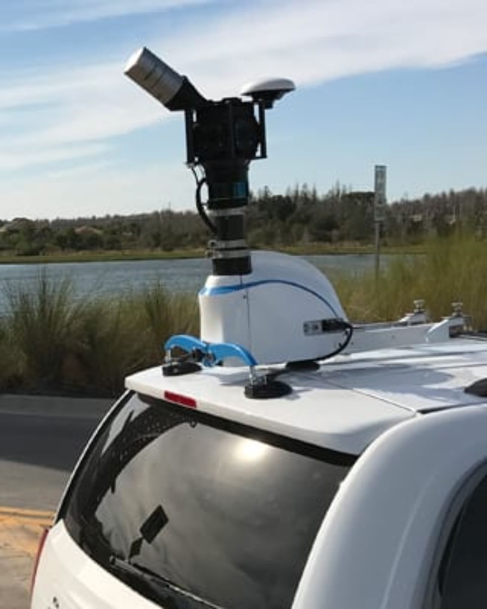
ASTRALiTE
SBG Systems dual INS/GNSS for UAV-based topographic & bathymetry
Topography and bathymetry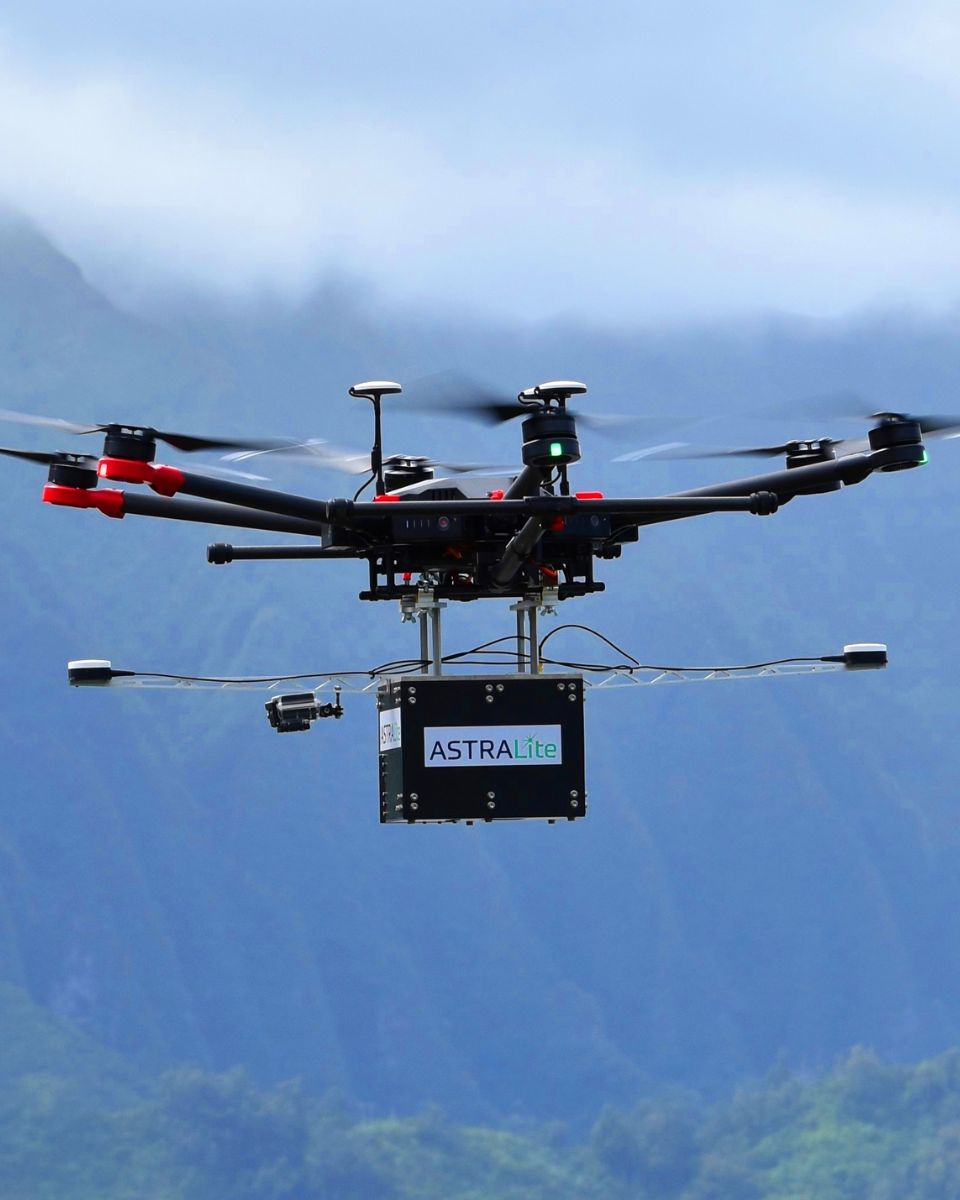


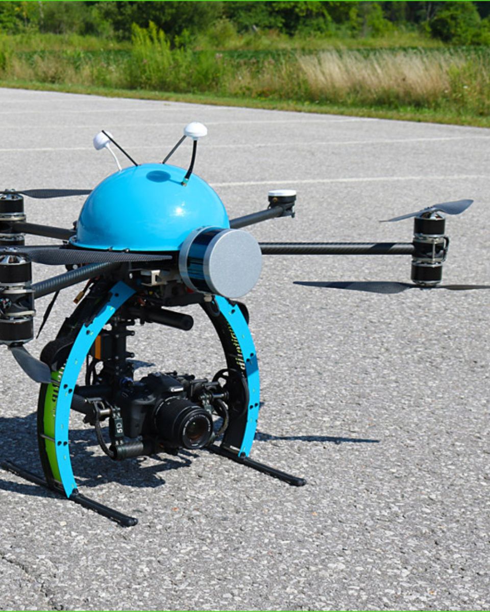
Eberhard Karls Universität
UAV flight analysis with miniature inertial sensor
Unmanned aerial vehicle (UAV)