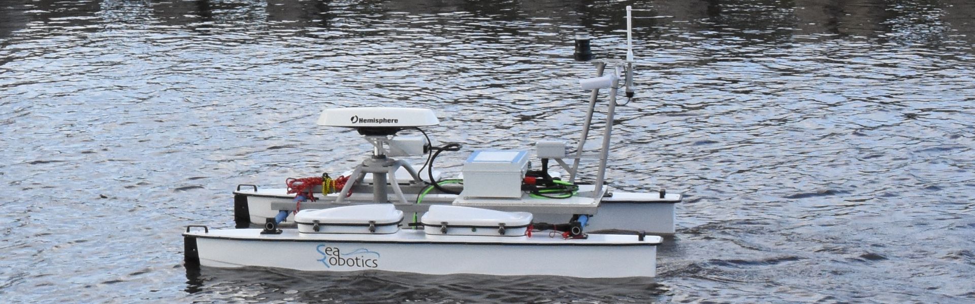
SeaRobotics USV with Ekinox-E
The SeaRobotics USV integrates Ekinox-E Inertial Navigation System for Multibeam compensation and data georeferencing.
“The Ekinox-E allows us to streamline system integration while still providing customers the ability to acquire and process high resolution bathymetry.” | Geoff D., Development Manager at SeaRobotics Corp.
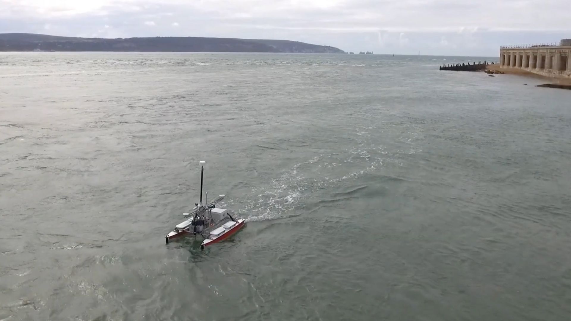
USV 2.5, The Smallest USV from SeaRobotics
The USV 2.5 is a 2.5 meter long Unmanned Surface Vehicle (USV) that offers a broad range instrumentation, with the flexibility to swap sensing payloads based on the demands of the mission. The USV 2.5 has been delivered to the Center for Marine Science and Technology at North Carolina State University.
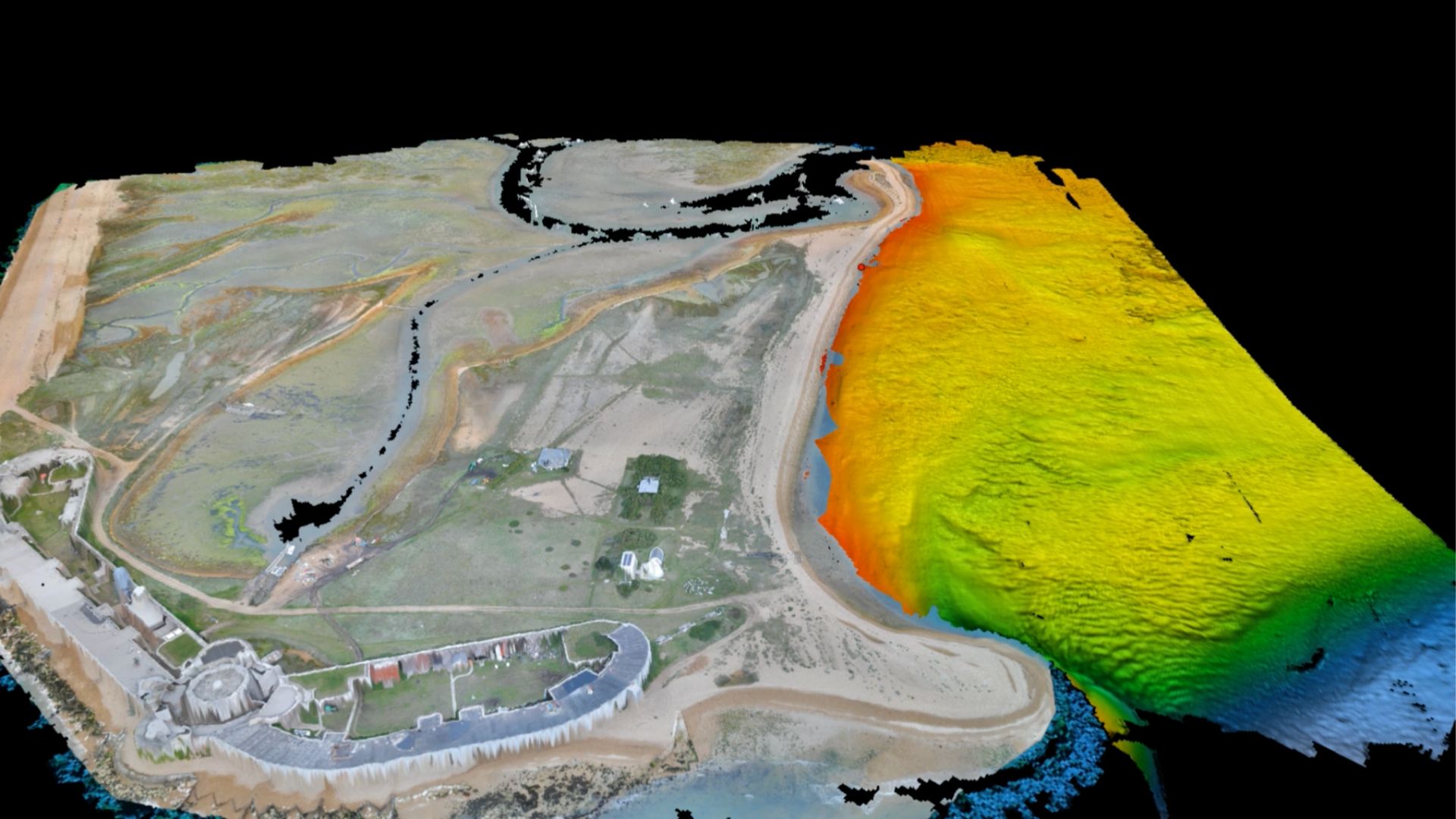
Fully Equipped for Bathymetry
The USV integrates:
- an Edgetech 6205 SwathBathymetric and Simultaneous Dual Frequency Side Scan Sonar System,
- a sound velocity probe,
- the highly flexible inertial navigation system Ekinox-E from SBG Systems connected to a dual antenna RTK GPS from Hemisphere,
- and HYPACK software.
Given the diverse capabilities of the USV, it will be utilized as both an experiential-based teaching tool and to conduct basic and applied research in lake, river, estuary, and costal environments.
“The USV will be used for seabed and water column mapping critical to an improved understanding of various marine and aquatic processes, including ecosystems dynamics, water quality, and shoreline stability”, stated Del Bohnenstiehl, principal investigator on the project.
Geof Douglass, Development Manager at SeaRobotics, stated, “We easily chose the Ekinox-E inertial navigation system for the USV 2.5.” Moreover, this decision highlights its reliability and performance.
“When compared to competing products with similar resolution, the Ekinox is much simpler to integrate because of its compact form factor. On small unmanned surface vehicles (USVs) available payload (weight, footprint, power, I/O) is the most precious asset. The Ekinox-E allows us to streamline system integration while still providing customers the ability to acquire and process high resolution bathymetry”, added Geof.
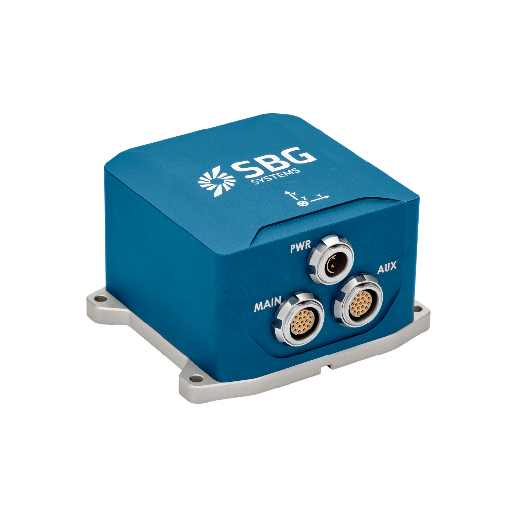
Ekinox-E
Ekinox-E accepts aiding data from an external GNSS receiver to provide navigation. Moreover, it connects to four external aiding systems, including DVL or DMI.
Our versatile inertial navigation system delivers orientation, heave, and navigation data effectively.
Ask a quotation for Ekinox-E
Do you have questions?
Welcome to our FAQ section! Here, you’ll find answers to the most common questions about the applications we showcase. If you don’t find what you’re looking for, feel free to contact us directly!
What are wave measurement sensors?
Wave measurement sensors are essential tools for understanding ocean dynamics and improving safety and efficiency in marine operations. By providing accurate and timely data on wave conditions, they help inform decisions across various sectors, from shipping and navigation to environmental conservation. Wave buoys are floating devices equipped with sensors to measure wave parameters such as height, period, and direction.
They typically use accelerometers or gyroscopes to detect wave motion (e.g. wave period) and can transmit real-time data to shore-based facilities for analysis.
What is bathymetry?
Bathymetry is the study and measurement of the depth and shape of underwater terrain, primarily focused on mapping the seafloor and other submerged landscapes. It is the underwater equivalent of topography, providing detailed insights into the underwater features of oceans, seas, lakes, and rivers. Bathymetry plays a crucial role in various applications, including navigation, marine construction, resource exploration, and environmental studies.
Modern bathymetric techniques rely on sonar systems, such as single-beam and multibeam echo sounders, which use sound waves to measure water depth. These devices send sound pulses toward the seafloor and record the time it takes for the echoes to return, calculating depth based on the speed of sound in water. Multibeam echo sounders, in particular, allow for wide swaths of the seafloor to be mapped at once, providing highly detailed and accurate seafloor representations. Frequently, a RTK + INS solution is associated to create accurately positioned 3D bathymetric representations of the seafloor.
Bathymetric data is essential for creating nautical charts, which help guide vessels safely by identifying potential underwater hazards like submerged rocks, wrecks, and sandbanks. It also plays a vital role in scientific research, helping researchers understand underwater geological features, ocean currents, and marine ecosystems.
What is a buoy used for?
A buoy is a floating device primarily used in maritime and water-based environments for several key purposes. Buoys are often placed in specific locations to mark safe passages, channels, or hazardous areas in bodies of water. They guide ships and vessels, helping them avoid dangerous spots like rocks, shallow waters, or wrecks.
They are used as anchoring points for vessels. Mooring buoys allow boats to tie up without having to drop anchor, which can be especially useful in areas where anchoring is impractical or damaging to the environment.
Instrumented buoys are equipped with sensors to measure environmental conditions like temperature, wave height, wind speed, and atmospheric pressure. These buoys provide valuable data for weather forecasting, climate research, and oceanographic studies.
Some buoys act as platforms for collecting and transmitting real-time data from the water or seabed, often used in scientific research, environmental monitoring, and military applications.
In commercial fishing, buoys mark the location of traps or nets. They also help in aquaculture, marking the locations of underwater farms.
Buoys can also mark designated areas such as no-anchoring zones, no-fishing zones, or swimming areas, helping enforce regulations on the water.
In all cases, buoys are critical for ensuring safety, facilitating marine activities, and supporting scientific research.
What is buoyancy?
Buoyancy is the force exerted by a fluid (such as water or air) that opposes the weight of an object submerged in it. It allows objects to float or rise to the surface if their density is less than that of the fluid. Buoyancy occurs because of the difference in pressure exerted on the object’s submerged portions—greater pressure is applied at lower depths, creating an upward force.
The principle of buoyancy is described by Archimedes’ principle, which states that the upward buoyant force on an object is equal to the weight of the fluid displaced by the object. If the buoyant force is greater than the object’s weight, it will float; if it is less, the object will sink. Buoyancy is essential in many fields, from marine engineering (designing ships and submarines) to the functionality of floating devices like buoys.
What is the inertial guidance system of a USV?
An inertial guidance system for an Unmanned Surface Vehicle (USV) is crucial for precise navigation and control, especially when GNSS is unavailable. Inertial sensors track motion and orientation, enabling effective navigation in challenging environments.
Inertial Navigation Systems (INS) integrate IMU data with other systems, such as GNSS or Doppler Velocity Logs, for enhanced accuracy. They also employ navigation algorithms, such as Kalman Filtering, to calculate position and velocity.
Inertial sensors support autonomous operation, providing accurate heading and position data for various applications. They ensure effective operation in GNSS-denied conditions and allow real-time adjustments for enhanced maneuverability.
