Utility field operations with Ellipse-D
The utility field operations are complex. Inspectors, engineers, and construction crews work across thousands of miles of infrastructure, often in difficult terrain and rapidly changing conditions. Yet much of their time goes to supporting tasks: traveling, measuring, documenting conditions, entering data, and communicating their findings.
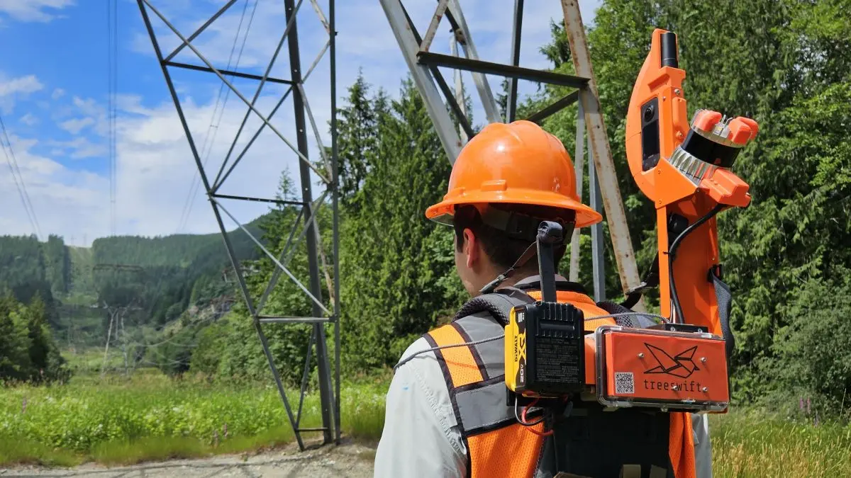
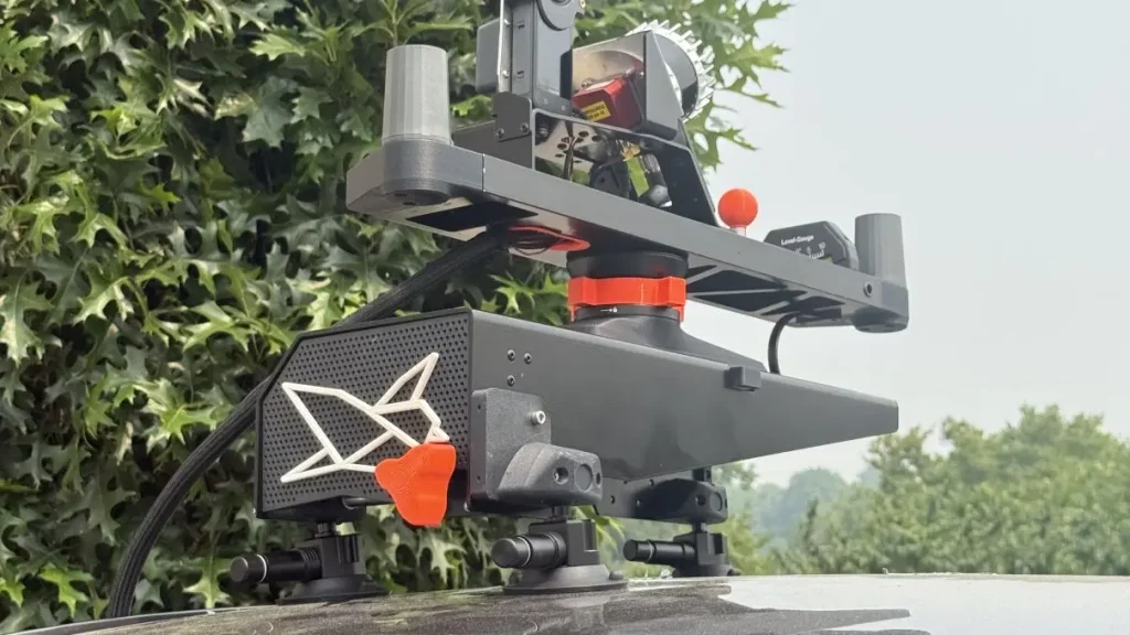
Treeswift is changing that by embedding sensing, AI, and software directly into utility field workflows. Its wearable Swiftpack and vehicle-mounted Swiftmount capture and structure information about the physical environment as work happens, helping field teams operate more efficiently while creating a richer record of conditions on the ground.
Reliable positioning is foundational to that system. Treeswift uses SBG Systems’ Ellipse-D inertial navigation system to provide the positioning and orientation needed to turn information collected in motion into trustworthy, spatially accurate field data.
“We evaluated several INS providers during our hardware development process. SBG Systems stood out because of its strong technical performance, product maturity, documentation, and reputation within the mobile mapping and robotics industries.”
Treeswift’s Product Team.
Rethinking the field visit
A utility field visit has traditionally been built around what one person can observe, measure, and document while on site. A typical field visit involves much more than the expert task itself. Workers navigate to sites, assess surrounding conditions, take measurements, document findings, and communicate that information to teams across the organization.
Treeswift turns that visit into something more useful. A worker wearing a Swiftpack can move through an inspection while LiDAR, imagery, positioning, and other sensors capture the surrounding environment. Treeswift processes that information into a structured digital record that can be used for vegetation management, asset inspection, construction, storm response, and other utility workflows.
This improves the productivity of the person doing the work, but the larger opportunity comes afterward. Information captured during one field visit can give supervisors, planners, QA teams, engineers, and subsequent crews a shared view of conditions on the ground, reducing manual documentation and unnecessary repeat work.
The positioning challenge
Building that shared field record creates a difficult positioning problem.
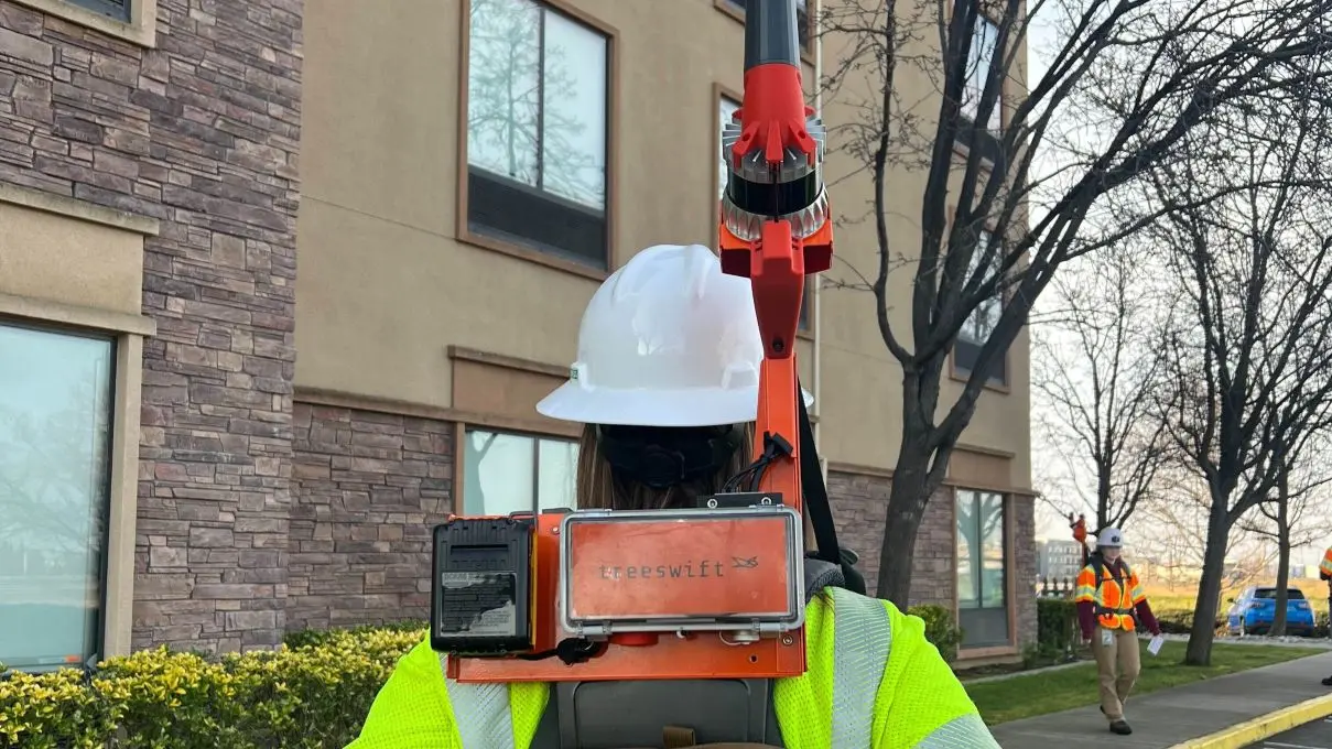
Treeswift’s systems are constantly moving through real-world utility environments. Swiftpacks travel with workers on foot and Swiftmounts operate from vehicles, often around vegetation, terrain, and structures that create changing GNSS conditions. The sensor data collected along the way only becomes useful when Treeswift can reliably determine where observations were made and how its sensors were oriented.
Treeswift therefore needed an industrial-grade inertial navigation system that could maintain accurate positioning and orientation through variable conditions while integrating cleanly into a synchronized, multi-sensor platform.
Treeswift also wanted to minimize the engineering burden associated with building and maintaining its own post-processing pipeline across multiple GNSS base station networks.
Why Treeswift chose SBG Systems
After evaluating several INS providers, Treeswift selected SBG Systems’ Ellipse-D based on technical performance, product maturity, documentation, and engineering support.
Ellipse-D is integrated directly alongside Treeswift’s LiDAR, cameras, and other sensors, providing a consistent navigation input for downstream processing.
SBG worked closely with Treeswift’s engineering team to validate its configuration early in development, while mature documentation and responsive engineering support reduced the effort required to bring the system into production.
Results and impact
Today, Treeswift deploys hundreds of Ellipse-D units across its Swiftpack and Swiftmount platforms, supporting vegetation management, asset inspection, construction, and storm response for major electric utilities.
At this scale, the technology has to work consistently wherever field operations take place. Ellipse-D provides a reliable positioning foundation across Treeswift’s fleet, allowing data captured by different workers, vehicles, and sensors to remain spatially accurate and useful downstream.
That field data becomes more valuable beyond the initial visit. Treeswift turns what workers capture on the ground into structured information that can support planning, quality assurance, engineering, and other operational decisions across the utility.
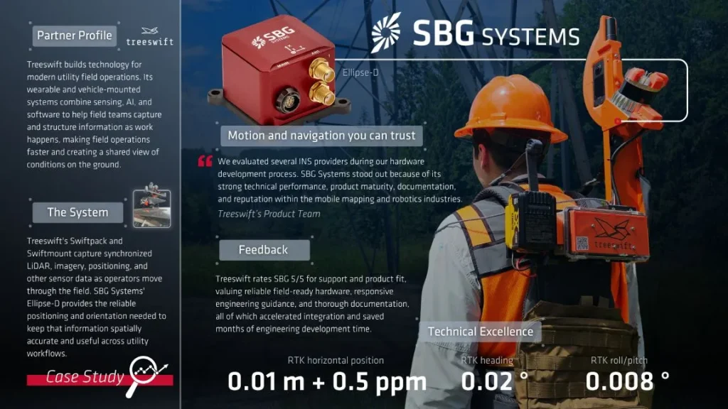
“Our technology has to work wherever fieldwork happens. Reliable positioning is foundational to turning what we capture on the ground into information the rest of the organization can trust. SBG has been a strong partner in helping us build that at scale,” concludes the Product Team, Treeswift.
For Treeswift, SBG has provided more than reliable hardware. Responsive engineering support and strong documentation have reduced integration overhead as Treeswift has moved from early development to large-scale field deployment.
Ellipse-D
The Ellipse-D is a compact, high-performance dual-antenna GNSS/INS solution built for centimeter-level positioning and orientation accuracy in demanding, real-world conditions.
Built on proven MEMS technology, it provides the reliability that mission-critical platforms demand. It supports wearable sensing devices, mobile mapping systems, and robotics applications.
Key features include tightly coupled GNSS/INS fusion and 0.2° dual-antenna heading accuracy. It also integrates seamlessly with third-party sensors, including LiDAR, cameras, and odometry.