Mapping under Bridges
State-of-the-art Hydrographic Equipment including the Apogee-E.
“DVL input in the Apogee-E is a big advantage. It helps for real-time GNSS outages, especially under bridges.” | Alexander S., Technical Sales Manager at MBT, MacArtney
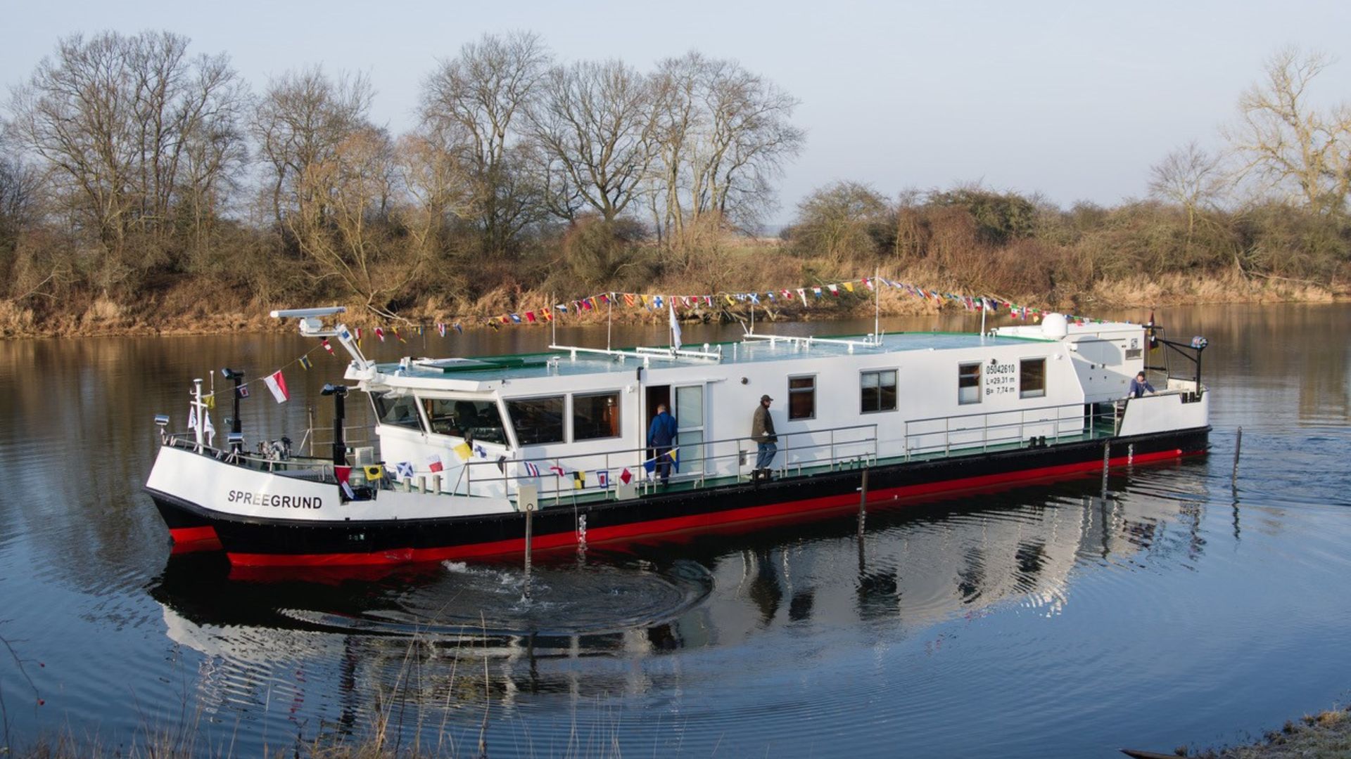
State-of-the-art Equipment for WSA Berlin
The vessel «Spreegrund», property of WSA Berlin, has been equipped by MacArtney Germany, with state-of- the-art equipment including the Apogee-E, the highest accuracy inertial navigation system from SBG.
The catamaran survey vessel named «Spreegrund» serves as survey vessel on German lakes, adjacent canals, and rivers (Berlin, Brandenburg, Eberswalde, and Lauenburg). It carries out complete surveys at speeds of up to 6 knots and water depths down to 20 meters.
State-of-the-art Hydrographic Equipment
The onboard equipment features:
– the first Teledyne RESON T20-P TripleHead multibeam echo sounder
– a Teledyne ODOM CV 100 single beam echo sounder,
– a Teledyne RDI Navigator DVL
– a Valeport SWiFT as well as a Valeport Ultra SV sound velocity sensor
– the data acquisition software QINSy
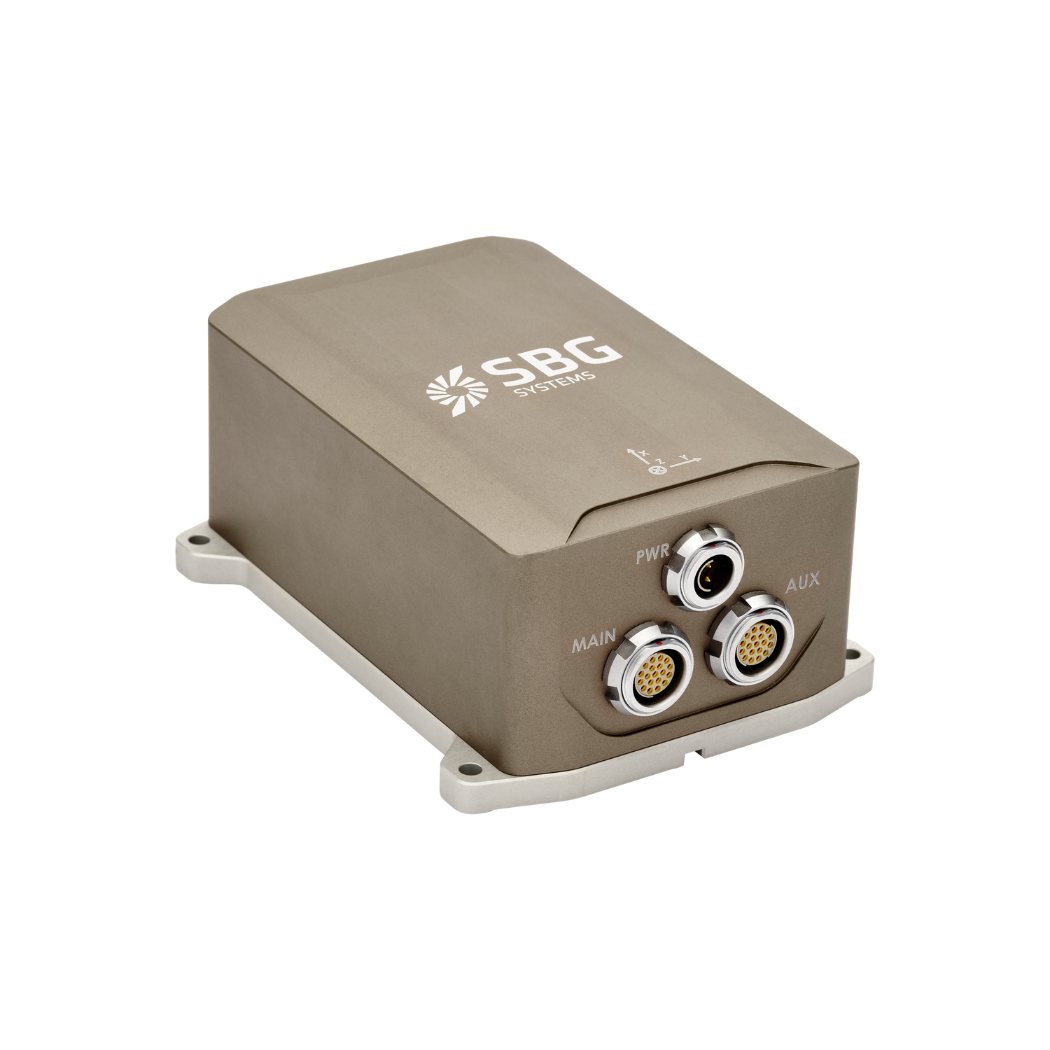
– and the SBG Apogee-E inertial navigation system supplied by MacArtney Germany together with two ObeLx-R GNSS heading receivers (Septentrio boards inside). The onboard control system and software work to ensure optimal data acquisition from the survey sensor suite. It is capable of handling enormous data stream of up to 25,000 soundings per second.
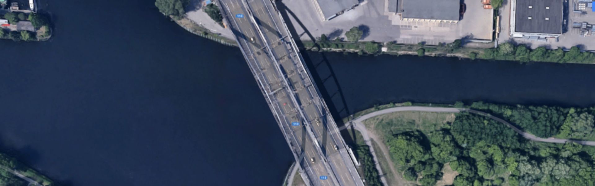
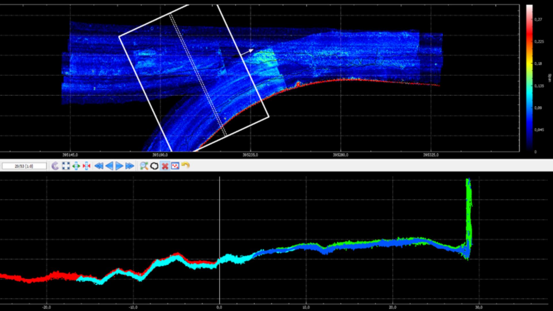
Charting under bridges with the Apogee INS
Surveying under bridges is a challenging application that fully requires the fusion between inertial and GNSS data. Indeed, GNSS receivers are perturbed when vessels are crossing bridges and may cause outages or incorrect data.
In the case of WSA Berlin, this is a day-to-day challenge, explaining why MacArtney chose an Apogee-E inertial navigation system connected with their own Dual-antenna GNSS receiver (Septentrio inside).
“We needed the highest accuracy INS to maintain the very high precision of the overall equipment,” states Alexander Schmidt from MacArtney Germany.
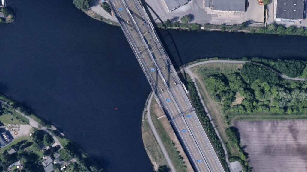
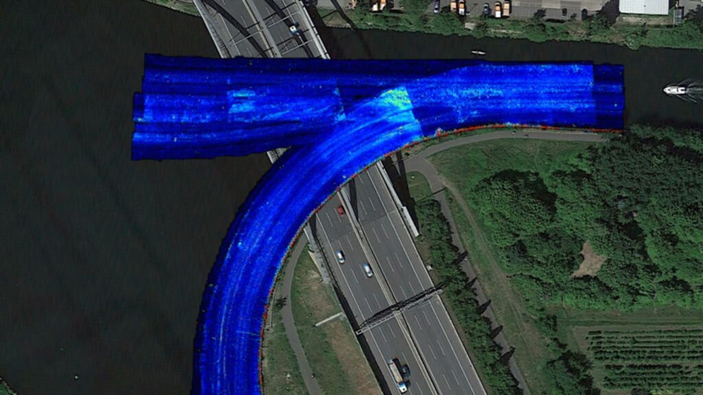
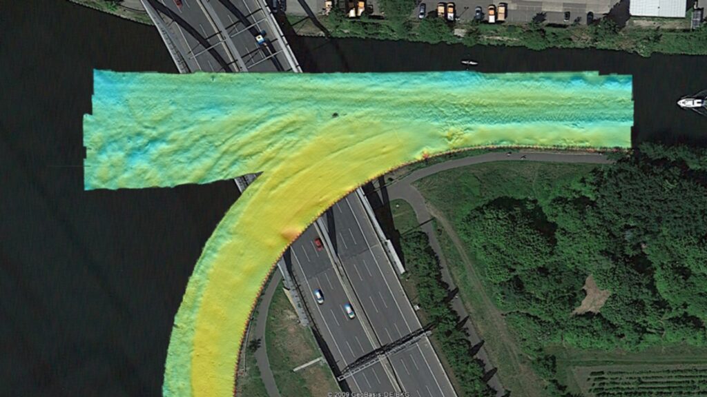
Mapping under bridges with Apogee INS
“We obtained excellent results with the Apogee-E, the images speak for themselves.” | Alexander S. from McArtney, Germany
Apogee-E
Apogee-E connects to any survey grade GNSS receiver for navigation and aiding equipment such as odometer or DVL.
This highly versatile Inertial Navigation System provides orientation, navigation, and heave data in real-time and post-processing.
Ask a quotation for Apogee-E
Do you have questions?
Welcome to our FAQ section! Here, you’ll find answers to the most common questions about the applications we showcase. If you don’t find what you’re looking for, feel free to contact us directly!
What are wave measurement sensors?
Wave measurement sensors are essential tools for understanding ocean dynamics and improving safety and efficiency in marine operations. By providing accurate and timely data on wave conditions, they help inform decisions across various sectors, from shipping and navigation to environmental conservation. Wave buoys are floating devices equipped with sensors to measure wave parameters such as height, period, and direction.
They typically use accelerometers or gyroscopes to detect wave motion (e.g. wave period) and can transmit real-time data to shore-based facilities for analysis.
What is bathymetry?
Bathymetry is the study and measurement of the depth and shape of underwater terrain, primarily focused on mapping the seafloor and other submerged landscapes. It is the underwater equivalent of topography, providing detailed insights into the underwater features of oceans, seas, lakes, and rivers. Bathymetry plays a crucial role in various applications, including navigation, marine construction, resource exploration, and environmental studies.
Modern bathymetric techniques rely on sonar systems, such as single-beam and multibeam echo sounders, which use sound waves to measure water depth. These devices send sound pulses toward the seafloor and record the time it takes for the echoes to return, calculating depth based on the speed of sound in water. Multibeam echo sounders, in particular, allow for wide swaths of the seafloor to be mapped at once, providing highly detailed and accurate seafloor representations. Frequently, a RTK + INS solution is associated to create accurately positioned 3D bathymetric representations of the seafloor.
Bathymetric data is essential for creating nautical charts, which help guide vessels safely by identifying potential underwater hazards like submerged rocks, wrecks, and sandbanks. It also plays a vital role in scientific research, helping researchers understand underwater geological features, ocean currents, and marine ecosystems.
What is hydrographic surveying?
Hydrographic surveying is the process of measuring and mapping physical features of bodies of water, including oceans, rivers, lakes, and coastal areas. It involves collecting data related to the depth, shape, and contours of the seafloor (seafloor mapping), as well as the location of submerged objects, navigational hazards, and other underwater features (e.g. water trenches). Hydrographic surveying is crucial for various applications, including navigation safety, coastal management and coastal survey, construction, and environmental monitoring.
Hydrographic surveying involves several key components, starting with bathymetry, which measures water depth and seafloor topography using sonar systems like single-beam or multi-beam echo sounders that send sound pulses to the seafloor and measure the echo’s return time.
Accurate positioning is critical, achieved using Global Navigation Satellite Systems (GNSS) and Inertial Navigation Systems (INS) to link depth measurements to precise geographic coordinates. Additionally, water column data, such as temperature, salinity, and currents, are measured, and geophysical data is collected to detect underwater objects, obstacles, or hazards using tools like side-scan sonar and magnetometers.
