Expedition Survey of Belize’s Great Blue Hole with Ellipse INS sensor
Aquatica Submarines equipped its Kongsberg surface and submarine-mounted sonar equipment with the Ellipse miniature INS.
“For the first time in history, an expedition of this scale was attempted at the Great Blue Hole.” | Aquatica Submarines
The Aquatica Submarines Expedition
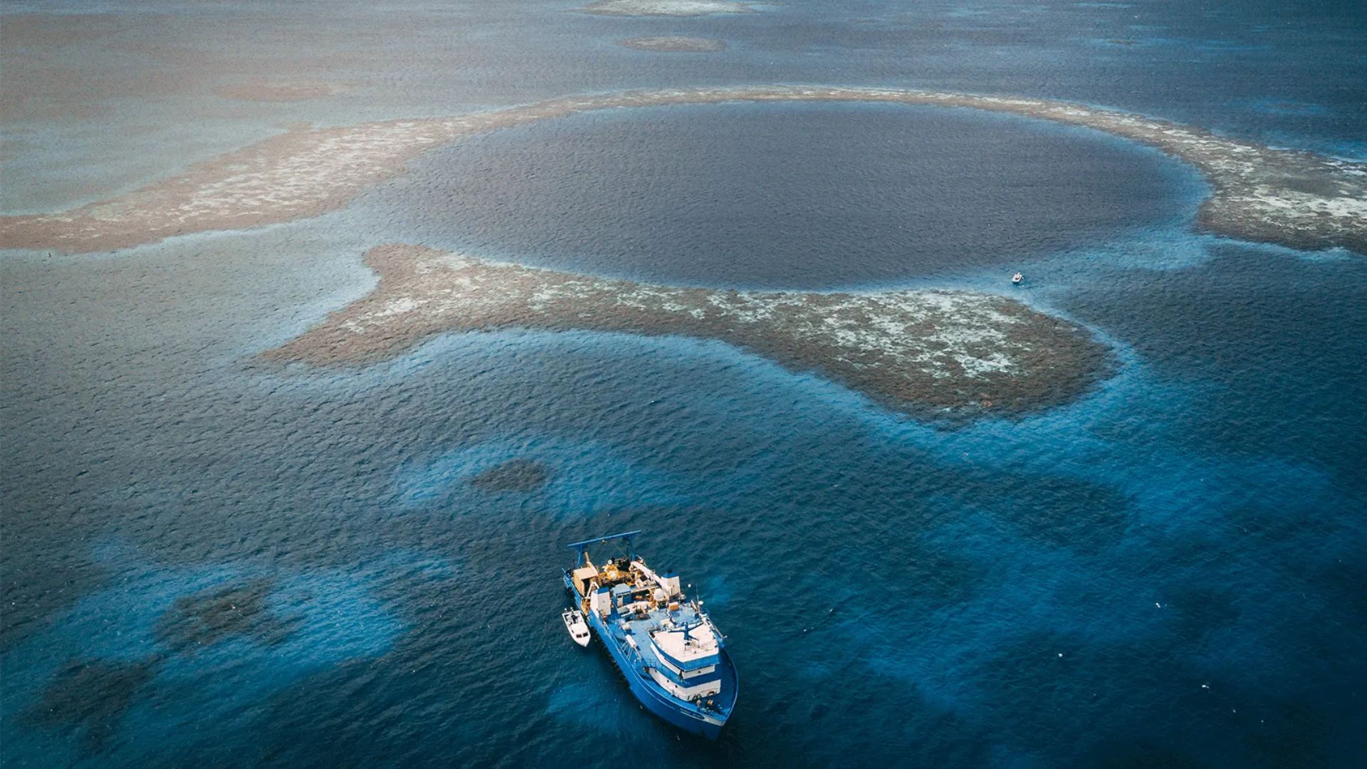
Aquatica Submarines led an expedition survey of Belize’s Great Blue Hole from November 27th to December 13th, 2019. Moreover, during two weeks, scientists, explorers, and filmmakers collected data while capturing photos and videos of this geological wonder. In addition, Virgin’s Sir Richard Branson and Fabien Cousteau, grandson of Jacques Cousteau, actively joined the expedition.
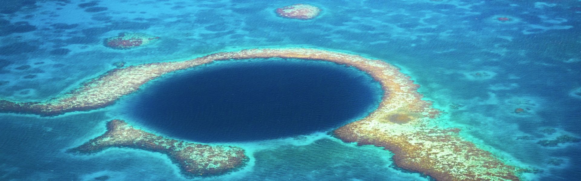
The Blue Hole is the largest marine sinkhole in the world, with its 300 meters diameter and its 125 meters depth.
This major scuba hotspot is part of the Belize Barrier Reef Reserve System and a UNESCO World Heritage Site. This expedition marks the first attempt in history to explore the Blue Hole on such a large scale.
This high-tech exploration aims to realize a sonar scan of the Blue Hole, collect scientific data, and to raise educational awareness.
Two submersibles equipped with sonar
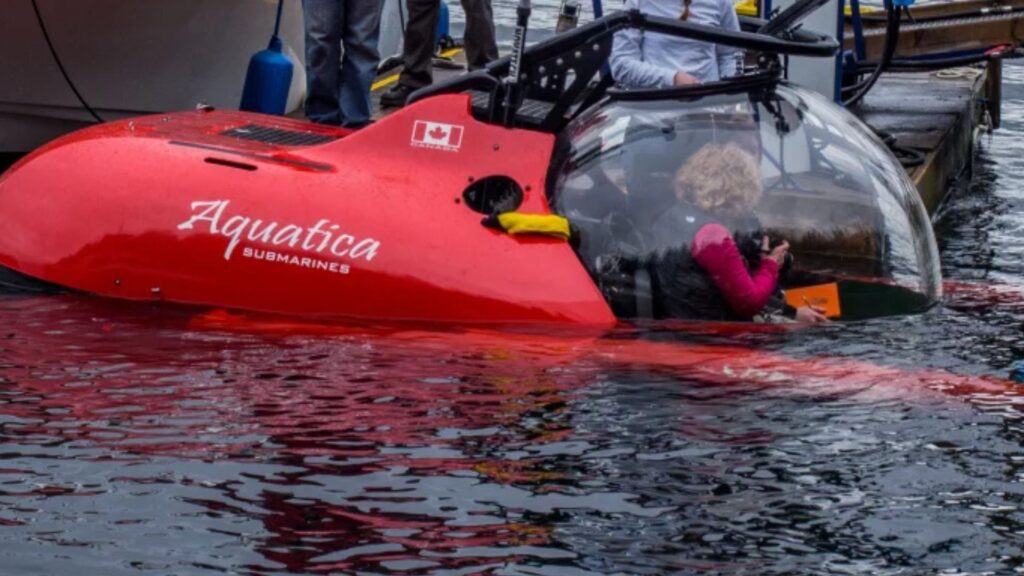
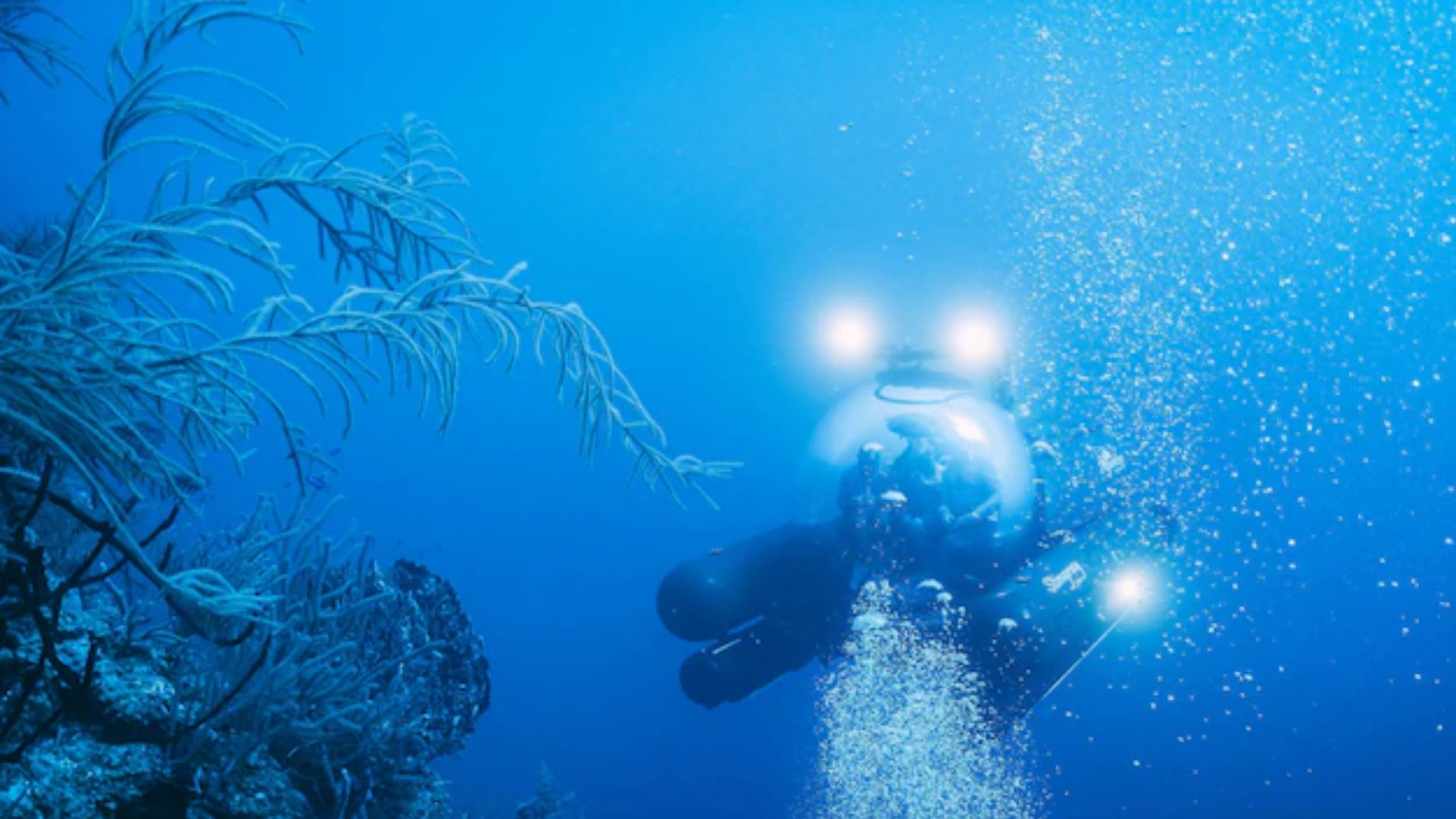
The expedition team deployed two submersibles to conduct the survey: its Stingray 500 and the Roatan Institute’s IDABEL.
Moreover, both submersibles can carry up to three people for a maximum of 12 hours. In addition, they offer large equipment platforms, making them ideal for carrying advanced exploration technology.
They used a Kongsberg dual-axis sonar to create a 3D representation of the sinkhole. Moreover, both surface and submarine-mounted sonar systems included SBG Systems’ Ellipse inertial sensor. In addition, the team positioned the Ellipse over suspended tripods to mark the Blue Hole perimeter. Finally, scientists instantly processed the recorded data using their MS1000 processing software.
High Resolution 3D sonar map
One of the expedition’s greatest achievements was creating a high-resolution 3D representation of the sinkhole. Moreover, it delivered the first 360-degree sonar map of the site, ensuring complete mapping.
Kongsberg’s dual-axis sonar collected point-cloud data to build the 3D map of the Blue Hole. In addition, the sonar was pole-mounted on the survey vessel, with GPS and a motion reference unit above the scanner head.
Once processed and finalized, the data will be shared with Belize’s government and the scientific community as a legacy.
Furthermore, another milestone was the two-hour live broadcast featuring Sir Richard Branson, Fabien Cousteau, and Aquatica’s Chief Pilot on Discovery Channel.

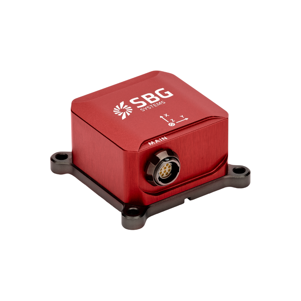
Ellipse-A
Ellipse-A offers an affordable and high-performance Attitude and Heading Reference System (AHRS). Moreover, it embeds a best-in-class magnetic calibration procedure to ensure optimal heading accuracy.
In addition, it suits low to medium dynamic applications effectively.
Factory calibrated from -40°C to 85°C, this robust sensor delivers Roll, Pitch, Heading, and Heave data.
Ask a quotation for Ellipse-A
Do you have questions?
Welcome to our FAQ section! Here, you will find answers to the most common questions about our showcased applications. Moreover, if you cannot find the information you need, please contact us directly for support.
What are wave measurement sensors?
Wave measurement sensors are essential tools for understanding ocean dynamics and improving safety and efficiency in marine operations. By providing accurate and timely data on wave conditions, they help inform decisions across various sectors, from shipping and navigation to environmental conservation. Wave buoys are floating devices equipped with sensors to measure wave parameters such as height, period, and direction.
They typically use accelerometers or gyroscopes to detect wave motion (e.g. wave period) and can transmit real-time data to shore-based facilities for analysis.
What is bathymetry?
Bathymetry is the study and measurement of the depth and shape of underwater terrain, primarily focused on mapping the seafloor and other submerged landscapes. It is the underwater equivalent of topography, providing detailed insights into the underwater features of oceans, seas, lakes, and rivers. Bathymetry plays a crucial role in various applications, including navigation, marine construction, resource exploration, and environmental studies.
Modern bathymetric techniques rely on sonar systems, such as single-beam and multibeam echo sounders, which use sound waves to measure water depth. These devices send sound pulses toward the seafloor and record the time it takes for the echoes to return, calculating depth based on the speed of sound in water. Multibeam echo sounders, in particular, allow for wide swaths of the seafloor to be mapped at once, providing highly detailed and accurate seafloor representations. Frequently, a RTK + INS solution is associated to create accurately positioned 3D bathymetric representations of the seafloor.
Bathymetric data is essential for creating nautical charts, which help guide vessels safely by identifying potential underwater hazards like submerged rocks, wrecks, and sandbanks. It also plays a vital role in scientific research, helping researchers understand underwater geological features, ocean currents, and marine ecosystems.
What is a buoy used for?
A buoy is a floating device primarily used in maritime and water-based environments for several key purposes. Buoys are often placed in specific locations to mark safe passages, channels, or hazardous areas in bodies of water. They guide ships and vessels, helping them avoid dangerous spots like rocks, shallow waters, or wrecks.
They are used as anchoring points for vessels. Mooring buoys allow boats to tie up without having to drop anchor, which can be especially useful in areas where anchoring is impractical or damaging to the environment.
Instrumented buoys are equipped with sensors to measure environmental conditions like temperature, wave height, wind speed, and atmospheric pressure. These buoys provide valuable data for weather forecasting, climate research, and oceanographic studies.
Some buoys act as platforms for collecting and transmitting real-time data from the water or seabed, often used in scientific research, environmental monitoring, and military applications.
In commercial fishing, buoys mark the location of traps or nets. They also help in aquaculture, marking the locations of underwater farms.
Buoys can also mark designated areas such as no-anchoring zones, no-fishing zones, or swimming areas, helping enforce regulations on the water.
In all cases, buoys are critical for ensuring safety, facilitating marine activities, and supporting scientific research.
What is buoyancy?
Buoyancy is the force exerted by a fluid (such as water or air) that opposes the weight of an object submerged in it. It allows objects to float or rise to the surface if their density is less than that of the fluid. Buoyancy occurs because of the difference in pressure exerted on the object’s submerged portions—greater pressure is applied at lower depths, creating an upward force.
The principle of buoyancy is described by Archimedes’ principle, which states that the upward buoyant force on an object is equal to the weight of the fluid displaced by the object. If the buoyant force is greater than the object’s weight, it will float; if it is less, the object will sink. Buoyancy is essential in many fields, from marine engineering (designing ships and submarines) to the functionality of floating devices like buoys.
