Qinertia GNSS/INS chosen for marine geophysical data post-processing
SBG’s Qinertia GNSS/INS PPK software used to post-process INS data for the precise positioning of marine geophysical surveys.
“The SBG Systems hardware and software have certainly met our expectations!” | Luke G., Hydrographer & Marine Geologist at Namdeb
Namdeb Diamond Corporation is an alluvial diamond mining company located in Oranjemund, Southern Namibia. They perform exploration, mining and rehabilitation operations. Namdeb’s rich history goes as far back as 1920.
The company use several innovative mining techniques to extract diamonds from alluvial deposits of ore bodies. For the survey, they adopt a wide range of methodologies in the terrestrial and marine environment to quantify mining activities and conduct exploration for potentially new mining sites.
Robust and cost-effective hardware
Namdeb team was looking for an upgrade of their old Inertial Navigation System and found the SBG’s Navsight Apogee to be of very similar specifications compared to their previous equipment, and at a far lower cost.
Our customer also found some appealing features in the hardware configuration to assist users during the initial setup. Furthermore they figured out that Qinertia PPK software offers more value than their previous solution.
SBG PPK software allows third-party data integration and delivers a photogrammetry module for precise georeferencing.
Their primary need for PPK software was to post-process INS data for precise positioning of marine geophysical survey.
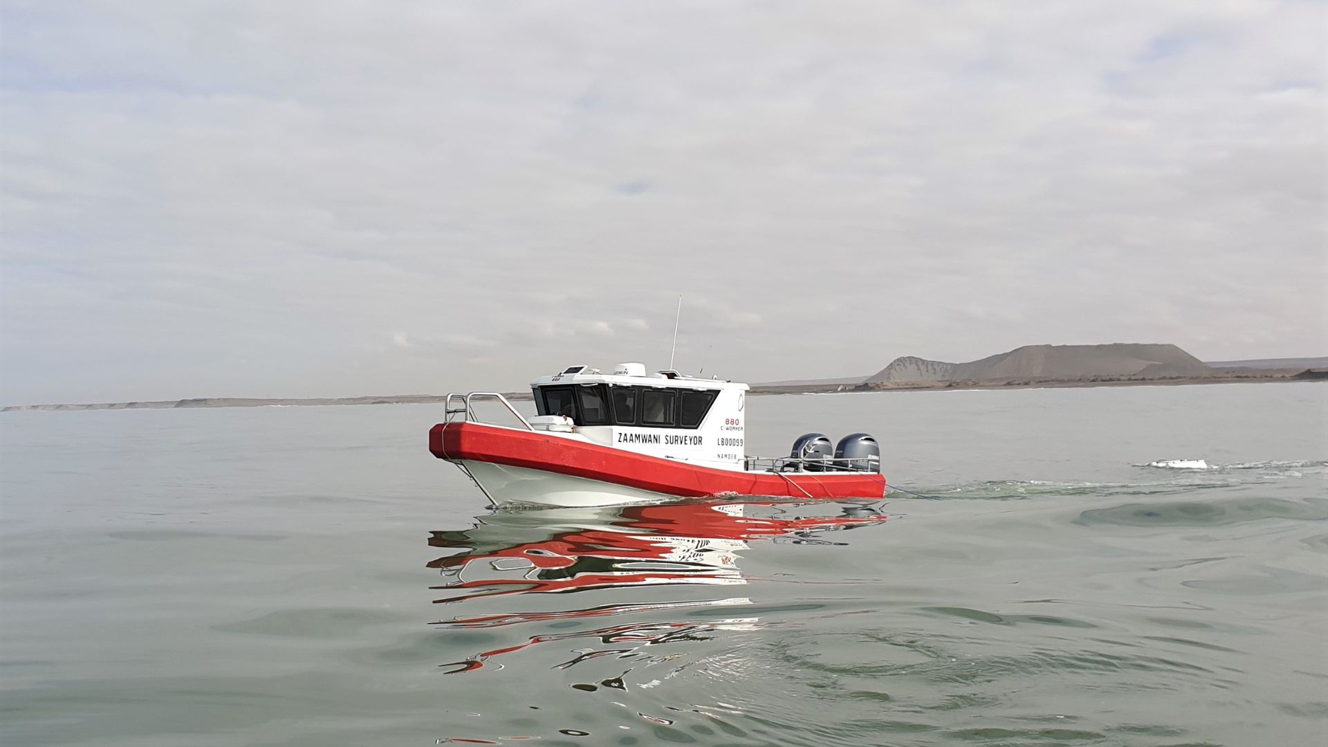
Qinertia is being used on a daily basis to post-process the Navsight Apogee missions from MBES surveys and PPK data from a Trimble GNSS receiver in SBES surveys.
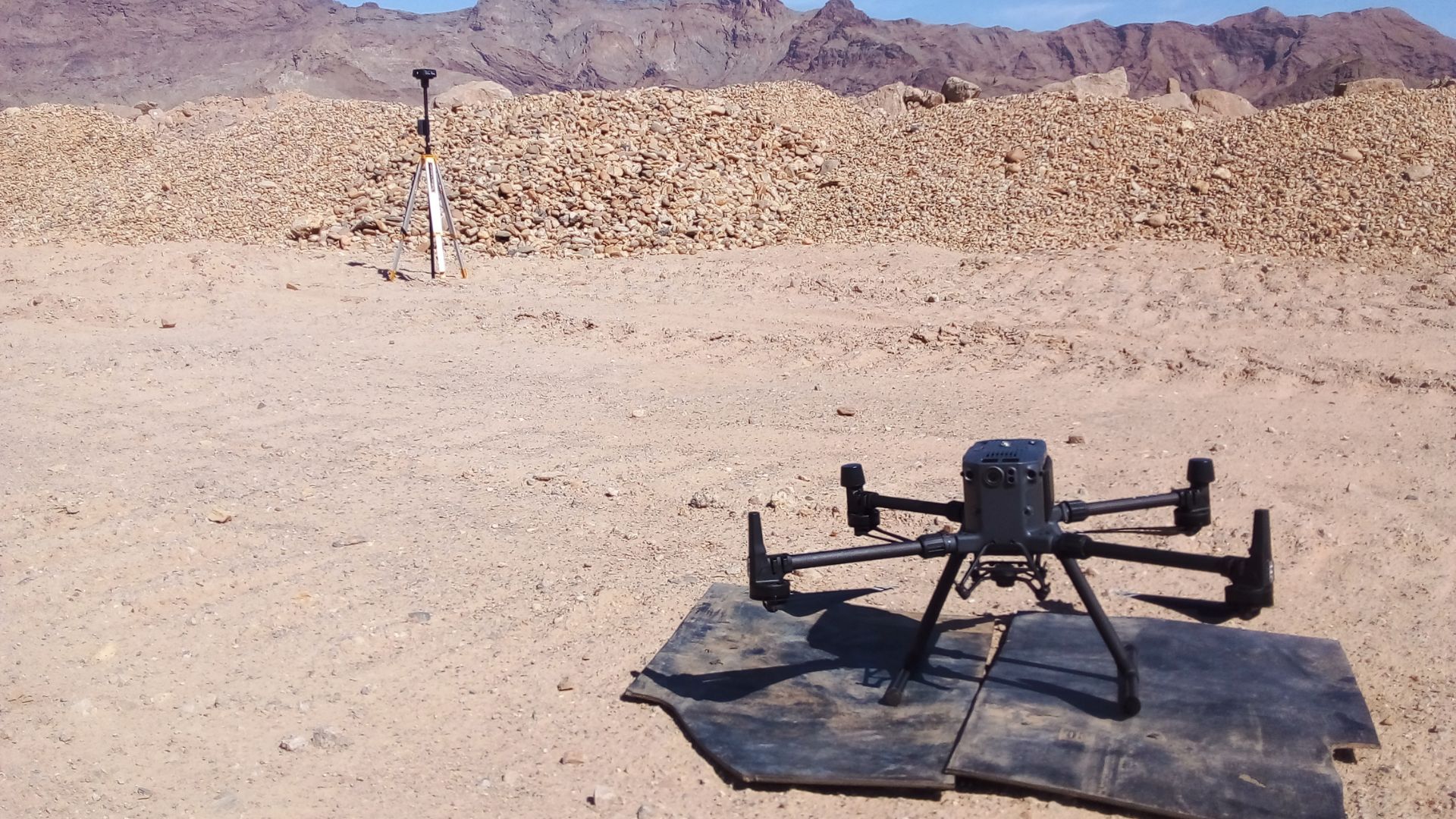
More recently it is used for photogrammetry processing from a DJI UAV.
Seamless integration with Qinertia GNSS/INS
No major challenges were faced regarding the hardware upgrade. The plug and play conception offers seamless integration of the INS system on the customer survey vessel.
Regarding the software, Namdeb was particularly satisfied with the system configuration and Qinertia GUI, graphically aiding the user in potential installation errors and data bias. In addition, the SBG team has always responded quickly to provide support.
About PPK software and MBES
Multibeam Echo Sounder Survey (MBES) is a geophysical survey method that uses sound waves to create high-resolution maps of the seafloor and subsurface structures.
They are commonly used in hydrography and geophysical exploration to determine water depths, bathymetry, and the location of geological features.
However, the accuracy of MBES surveys are sometime limited by the accuracy or disturbances of the INS positioning system used to collect data about the vessel position.
PPK software solve these issues by processing INS data collected during the mission to provide highly accurate positions of the MBES survey vessel.
To do so, they use advanced algorithms to correct GNSS data for errors, such as ionospheric and tropospheric delay, and to remove any biases that may be present.
This results in a highly accurate and reliable position for the survey vessel, which is then incorporated into the MBES data to increase their accuracy.


Qinertia GNSS+INS PPK software
Qinertia PPK software offers an all-new level in high-precision positioning solutions.
Achieve unparalleled accuracy in your workflows by post-processing your raw location data.

Ask a quotation for Qinertia
Do you have questions?
Welcome to our FAQ section! Here, you’ll find answers to the most common questions about the applications we showcase. If you don’t find what you’re looking for, feel free to contact us directly!
What is the difference between RTK and PPK?
Real-Time Kinematic (RTK) is a positioning technique where GNSS corrections are transmitted in near real time, typically using an RTCM format correction stream. However, there can be challenges in ensuring the GNSS corrections, specifically their completeness, availability, coverage, and compatibility.
The major advantage of PPK over RTK post processing is that the data processing activities can be optimized during post-processing, including forward and backward processing, whereas in real-time processing, any interruption or incompatibility in the corrections and their transmission will lead to lower accuracy positioning.
A first key advantage of GNSS post-processing (PPK) vs. real time (RTK) is that the system used on the field does not need to have a datalink/radio to feed the RTCM corrections coming from the CORS into the INS/GNSS system.
The main limitation to post processing adoption is the requirement of the final application to act on the environment. On the other hand, if your application can withstand the additional processing time needed to produce an optimized trajectory, it will greatly improve the data quality for all your deliverables.
How does forward and backward processing works?
Let’s imagine we have a 60-second GNSS outage in the middle of our survey. The position error in forward processing grows fast (rate depends on the IMU specifications and other parameters) and reaches its maximum at the end of the outage. It then quickly recovers. In post processing, we pretend that time flows backward and do the processing in anti-chronological order as the physical equations remains valid. In this backward processing, the error would be maximum at the actual beginning of the GNSS outage in a very symmetrical way to the natural forward processing.
Merging those two computation results in a maximum error around the middle of the outage, with a much lower magnitude than the forward only or backward only solutions.This will especially improve GNSS+INS solutions as allowed by SBG Systems products, but GNSS only processing will also benefit from this workflow.
As already stated, this improvement can only be done via post-processing, as you need all the data to be available from start to the end, hence delaying its use to the end of the survey.
What is GNSS post-processing?
GNSS post-processing, or PPK, is an approach where the raw GNSS data measurements logged on a GNSS receiver are processed after the data acquisition activity. They can be combined with other sources of GNSS measurements to provide the most complete and accurate kinematic trajectory for that GNSS receiver, even in the most challenging environments.
These other sources can be local GNSS base station at or near the data acquisition project, or existing continuously operating reference stations (CORS) typically offered by governmental agencies and/or commercial CORS network providers.
A Post-Processing Kinematic (PPK) software can make use of freely available GNSS satellite orbit and clock information, to help further improve the accuracy. PPK allow for precise determination of a local GNSS base station’s location in an absolute global coordinate reference frame datum, which is used.
PPK software can also support complex transformations between different coordinate reference frames in support of engineering projects.
In other words, it gives access to corrections, enhances the project’s accuracy, and can even repair data losses or errors during the survey or installation after the mission.
What is Precise Point Positioning?
Precise Point Positioning (PPP) is a satellite navigation technique that offers high-precision positioning by correcting satellite signal errors. Unlike traditional GNSS methods, which often rely on ground-based reference stations (like in RTK), PPP utilizes global satellite data and advanced algorithms to provide accurate location information.
PPP works anywhere in the world without the need for local reference stations. This makes it suitable for applications in remote or challenging environments where ground infrastructure is lacking. By using precise satellite orbit and clock data, along with corrections for atmospheric and multipath effects, PPP minimizes common GNSS errors and can achieve centimeter-level accuracy.
While PPP can be used for post-processed positioning, which involves analyzing collected data after the fact, it can also provide real-time positioning solutions. Real-time PPP (RTPPP) is increasingly available, allowing users to receive corrections and determine their position in real time.
