Advanced motion and orientation data for precision farming
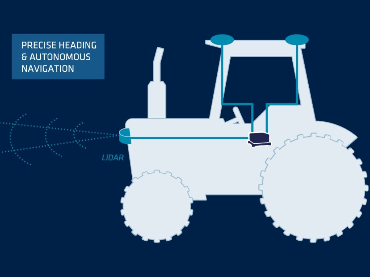
Our inertial systems provide precise positioning and orientation data, which is crucial for the effective management of farm machinery. This level of accuracy is vital for tasks such as mechanical weeding, planting, spraying, and harvesting, where even small deviations can lead to significant losses in productivity. Our INS ensures that farm machinery such as autonomous tractors or agricultural robots, can follow exact paths, reducing overlaps and gaps, and thus optimizing the use of resources and minimizing the application of inputs such as seeds, fertilizers, and pesticides.
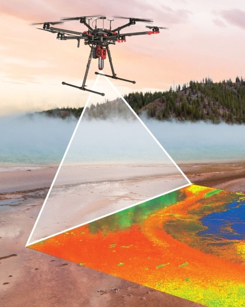
INS systems are particularly useful in environments where GNSS signals may be weak or unavailable, such as under tree canopies or in areas with significant terrain variation. The combination of INS with GNSS, ensures that agricultural vehicles (ex: farming robots) can navigate with centimeter accuracy, even in challenging conditions.
Reducing smart agriculture operational costs
By improving the accuracy of farming operations, our smart farming solutions help reduce operational costs while eliminating labor intensive tasks in applications such as mechanical weeding. Precision in planting and spraying means that inputs are applied only where needed, reducing wastage, and lowering the cost of seeds, fertilizers, and pesticides. Additionally, the efficiency gained through precise navigation reduces fuel consumption and wear on machinery, further lowering operational expenses.
Download our brochure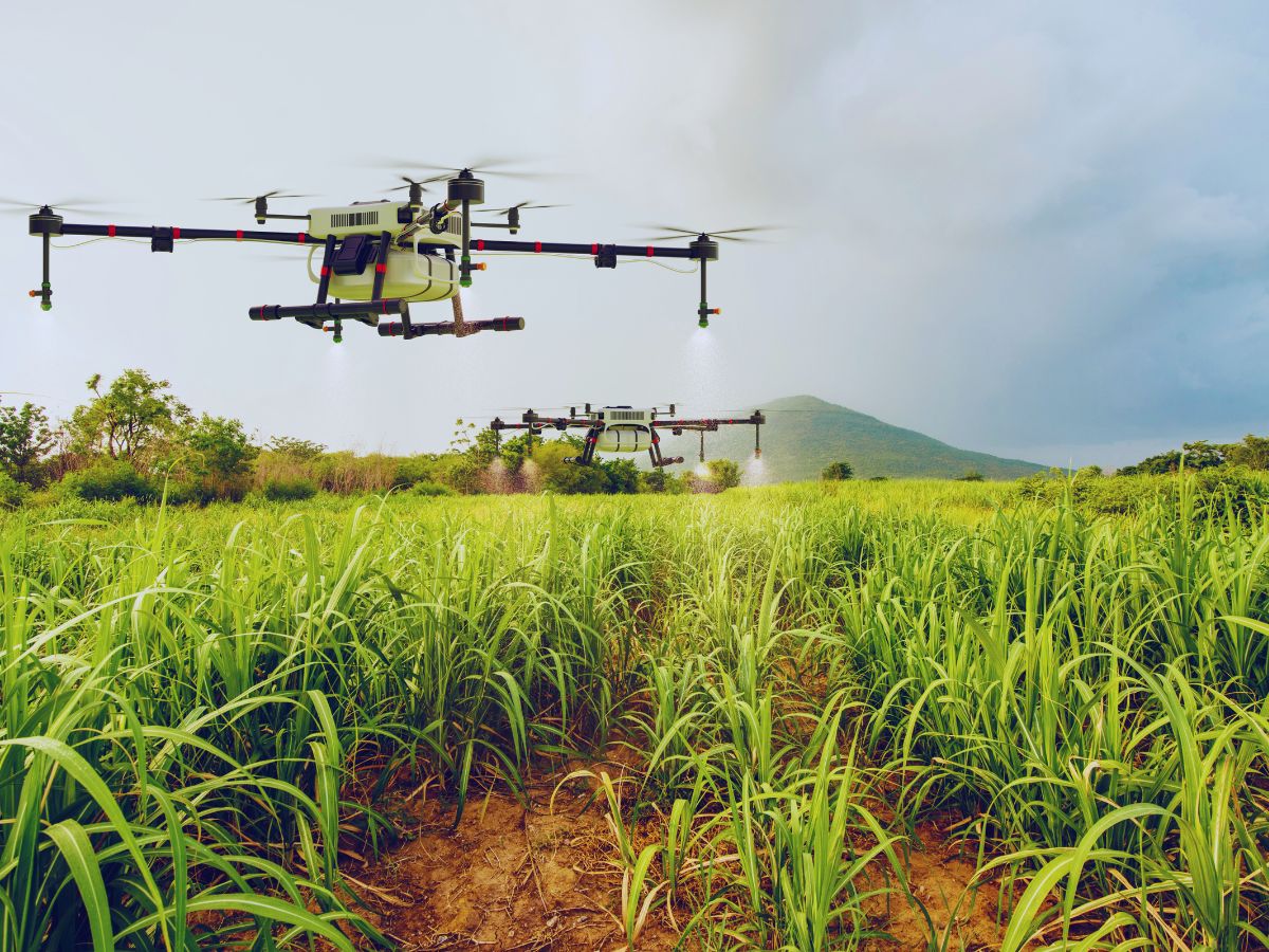
Minimizing environmental impact
Precision farming with high accuracy INS sensors not only boosts productivity but also minimizes environmental impact. By replacing chemicals with mechanical alternatives, or by ensuring that chemicals are applied only where necessary and in the correct amounts, these precision agriculture technology reduce the risk of over-application, which can lead to runoff and contamination of water sources. This targeted approach supports sustainable farming practices, helping to protect the environment while keeping all benefits of precision agriculture and maintaining high levels of agricultural output.
Tell us about your project
Our solutions for precision farming
Our sensors integrate seamlessly with precision agriculture platforms to deliver reliable performance, even the most challenging field conditions.

Ellipse-D
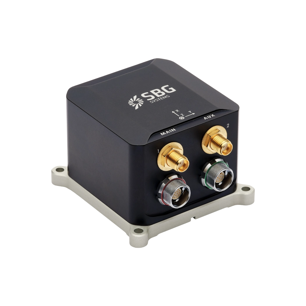
Ekinox Micro

OEM Ellipse-D
Autonomous applications brochure
Receive our brochure instantly in your inbox!
Case studies
Discover our case studies related to your application.
They talk about us
Hear first hand, from the innovators and clients who have adopted our technology.
Their testimonials and success stories illustrate the significant impact our sensors have in practical UAV navigation applications.
Discover other geospatial applications
Explore how our advanced inertial navigation and motion sensing solutions support a wide range of geospatial applications.
Our technology supports many applications, including topographic mapping and infrastructure inspection. Moreover, it enables mobile mapping and environmental monitoring. In addition, it delivers accurate and reliable data in any environment. Discover the possibilities across the geospatial landscape.
Do you have questions?
Welcome to our FAQ section! Here, you’ll find answers to the most common questions about the applications we showcase. If you don’t find what you’re looking for, feel free to contact us directly!
What is precision agriculture?
Precision agriculture is a modern farming approach that uses technology to monitor and manage field variability in crops. The goal is to optimize field-level management with the help of information technology. Here’s a breakdown of how it works and its benefits:
- Data Collection: Farmers use various tools like GPS, sensors, drones, and satellite imagery to collect detailed data on soil conditions, crop health, and weather patterns. This data helps in understanding the specific needs of different parts of a field.
- Analysis: The collected data is analyzed to identify patterns and trends. This might include soil moisture levels, nutrient deficiencies, pest populations, or crop growth rates.
- Variable Rate Application: Based on the analysis, farmers can apply inputs such as water, fertilizers, and pesticides at variable rates, tailored to the specific needs of different areas within a field. For instance, areas with poor soil may receive more fertilizer, while areas with sufficient nutrients might get less.
- Improved Efficiency: By applying resources more precisely, farmers can reduce waste, lower costs, and increase yields. This also helps in minimizing the environmental impact by avoiding over-application of chemicals.
- Monitoring and Adjustment: Continuous monitoring allows for real-time adjustments and ongoing optimization. Farmers can track the effectiveness of their interventions and adapt their strategies as needed.
How are drones used for agricultural purposes?
Drones are increasingly used in agriculture to enhance crop management and boost productivity. Equipped with high-resolution cameras and sensors, farming drones provide aerial imagery and data on crop health, soil conditions, and field variability. This allows farmers to monitor large areas quickly and identify issues such as pest infestations, nutrient deficiencies, and water stress with precision.
Drones in agriculture are used for precision application of inputs like fertilizers, pesticides, and herbicides. By targeting specific areas with accuracy, drones reduce waste and minimize environmental impact. Additionally, they assist in agriculture drone mapping and planning field layouts, and monitoring crop growth and yields over time.
Overall, farming drones offer a cost-effective and efficient way to gather critical information, make informed decisions, and implement targeted interventions, leading to improved crop management and resource use.
What is smart farming?
Smart farming enhances agriculture by integrating technology to boost efficiency, productivity, and sustainability. It uses IoT devices like sensors and GPS for real-time data on soil, weather, and crops.
Data analytics, automation, and autonomous robots in agriculture—such as drones and autonomous machinery—optimize tasks like irrigation and harvesting. Precision agriculture applies resources like water and fertilizers more accurately, improving yields and reducing waste. AI analyzes data for predictions and recommendations, while remote sensing provides high-resolution crop and field insights. By optimizing resource use and minimizing waste, smart farming supports sustainability and relies on high-speed internet for effective technology integration and real-time management.
What is inertial navigation ?
Inertial navigation is a method of determining the position, orientation, and motion of a vehicle using only internal sensors, without relying on external signals like GPS. At its core, an inertial navigation system (INS) measures how an object moves by continuously tracking its acceleration and rotation in three dimensions. It uses an Inertial Measurement Unit (IMU), which contains accelerometers to sense linear acceleration and gyroscopes to measure angular rate. By mathematically integrating these measurements over time, the system computes velocity, attitude, and eventually position relative to a known starting point.
Because it is entirely self-contained, inertial navigation works in any environment—underground, underwater, in space, or in GPS-denied conditions—making it indispensable for applications such as missiles, aircraft, submarines, autonomous vehicles, and robotics. Modern INS solutions often combine inertial sensors with additional aiding sources, like GNSS receivers, magnetometers, barometers, or Doppler velocity logs, to reduce drift and improve long-term accuracy. High-performance INS rely on precise sensor calibration, advanced filtering algorithms, and robust error modeling to deliver stable, reliable navigation data even in the most demanding environments.
What is aerial photogrammetry ?
Aerial photogrammetry is the science and technology of obtaining accurate measurements and spatial information about the Earth’s surface by analyzing photographs taken from airborne platforms, such as airplanes, drones, or helicopters. The fundamental principle behind aerial photogrammetry is that by capturing overlapping images of the terrain from different viewpoints, one can reconstruct three-dimensional information through geometric relationships. Each photograph serves as a two-dimensional projection of the three-dimensional world, and by identifying common points in multiple images, the exact positions of these points in space can be calculated using triangulation.
Modern aerial photogrammetry relies heavily on the integration of precise positioning and orientation data from inertial navigation systems (INS) and Global Navigation Satellite Systems (GNSS). The INS provides real-time measurements of the platform’s acceleration and angular velocity, which, when coupled with GNSS position data, allows for highly accurate determination of the camera’s position and orientation at the moment of image capture. This integration is crucial because it ensures that the photogrammetric models are georeferenced correctly, reducing errors caused by platform motion, vibrations, or GPS outages.
Once the images and positioning data are processed, photogrammetrists can generate detailed digital elevation models (DEMs), orthophotos, and three-dimensional maps of the surveyed area. Aerial photogrammetry is widely used in applications ranging from topographic mapping and urban planning to precision agriculture, forestry, environmental monitoring, and infrastructure inspection, where rapid, accurate, and high-resolution spatial information is required over large areas. The combination of high-quality imagery, precise inertial measurements, and advanced processing algorithms has transformed aerial photogrammetry into a highly reliable tool for both scientific research and operational applications.
