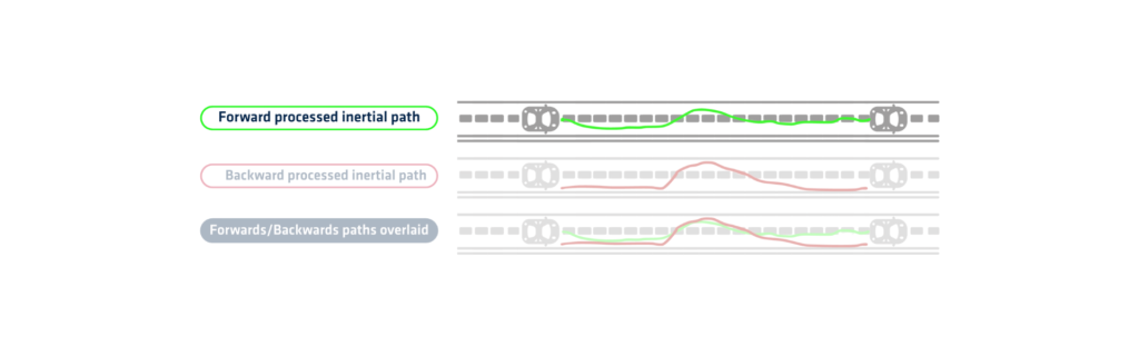
Forward processing is a method used in GNSS data post-processing to improve positioning accuracy after data collection. It calculates the solution by processing the data chronologically from the beginning of the survey to the end. This method relies on raw GNSS observations recorded during the mission, along with reference station data or correction information. This method uses algorithms to estimate position, velocity, and orientation over time.
The software analyzes satellite signals received during the survey. It applies models to account for satellite orbits, atmospheric delays, and signal errors. As the processing moves forward in time, it predicts positions (forward processed inertial path) based on previous epochs and corrects them using current data. This step-by-step approach helps in identifying and minimizing errors over time.
Forward processing works well in stable GNSS environments with consistent satellite visibility. It is especially useful when real-time corrections are unavailable or unreliable. When combined with inertial data from an IMU, it improves trajectory estimation in areas with temporary signal loss. The method can also apply Kalman filtering to smooth and refine the solution.
One limitation of forward processing is its sensitivity to long GNSS outages or poor signal quality. In such cases, the accuracy may degrade over time. To overcome this, users often complement it with backward or combined (merged) processing. Forward processing provides a strong foundation for comparison and validation in multi-pass workflows.
Many GNSS PPK software tools support forward-only computation. This allows users to inspect the raw trajectory independently before applying other techniques. Surveyors, engineers, and researchers rely on it to validate field data and ensure precise results. This technique plays a critical role in geodetic studies, UAV navigation, and mobile mapping.
In summary, forward processing delivers a robust, time-sequential solution that enhances GNSS accuracy in post-mission workflows and complex survey environments.
Qinertia GNSS+INS PPK software
Qinertia PPK software offers an all-new level in high-precision positioning solutions. Achieve unparalleled accuracy in your workflows by post-processing your raw location data.
Discover all features