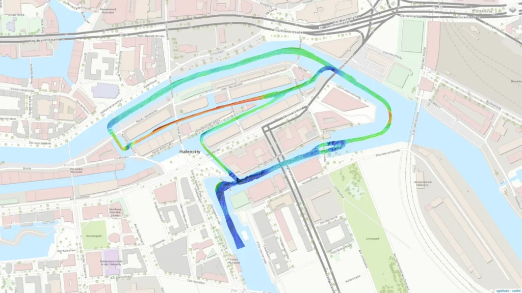
SBG Systems is proud to present the Speicherstadt survey map, an interactive visualization showcasing high-resolution bathymetric data collected along the intricate canal network of Hamburg’s historic Speicherstadt district. This unique dataset captures the river surface of the Elbe as it winds through the narrow channels and under the bridges of this UNESCO World Heritage Site.
Our survey was conducted using a tightly coupled Horizon Inertial Navigation System (INS) solution, which served as the reference for the bathymetric difference surfaces. This high-performance system was integrated with a Multibeam Echosounder (MBES) to enable precise motion compensation and georeferenced depth measurements, even within the GNSS-challenged, confined urban waterway environment of the Speicherstadt. A high-end fibre-optic gyroscope system was also deployed as a comparative sensor, providing an additional layer of validation for the collected data.
What can you explore in our survey map ?
The Speicherstadt survey map interface includes key layers that allow users to analyze the bathymetric quality across the survey area. These include computed depth models, trajectory lines, and quality metrics that highlight the consistency and precision of the recorded data. The narrow, complex geometry of the Speicherstadt channels presented a demanding environment for inertial navigation—but the Horizon grade system demonstrated exceptional performance throughout the mission.
This survey not only illustrates the capability of advanced INS systems to operate in GNSS-degraded conditions, but also serves as a benchmark for comparing different sensor technologies in similar urban survey scenarios. The resulting bathymetric surface is clear, consistent, and highly detailed, offering valuable insights for hydrographic surveyors, city engineers, and infrastructure planners.
We invite professionals and researchers to explore the Speicherstadt survey map, interact with the dataset, and assess the precision and quality of the bathymetric data generated using SBG Systems’ navigation technologies. This visualization is more than just a survey output—it’s a powerful tool for understanding how integrated navigation systems perform in one of Europe’s most iconic and technically challenging waterway networks.
How to use the Speicherstadt canals map visualization:
1 – One continuous click with 1 finger for a 360º move.
2 – Use trackpad 2 fingers gesture for zoom in/out
3 – Select all features you want to be presented (e.g. colors, survey line, etc.)
Get full access to other SBG Systems’ products test reports.