SBG Systems, a global leader in inertial navigation solutions, partnered with MacArtney Germany GmbH to equip a survey vessel with a complete Multibeam Echosounder (MBES) configuration to evaluate the performance of SBG’s Inertial Navigation Systems (INS) under real-world, challenging conditions. Considering this, we conducted our live demonstration as part of a focused three-day bathymetric survey in Hamburg, Germany. Notably, this location represents an ideal location thanks to its dynamic port environment and complex tidal influences.
Subsequently, the team designed the test campaign to assess the robustness, accuracy, and reliability of SBG’s inertial sensors. In particular, the goal was to simulate real-world conditions that reflect the daily challenges hydrographic survey professionals typically encounter. Therefore, the survey vessel carried a full suite of advanced hydrographic instruments. This included a state-of-the-art Multibeam Echosounder system integrated with SBG’s high-performance Inertial Navigation System (INS). This configuration enabled precise motion compensation and reliable georeferencing, even in highly dynamic and GNSS-intermittent environments.
The survey, SBG’s INS demonstrated outstanding performance, delivering consistent navigation data that ensured the quality and clarity of bathymetric measurements. The seamless integration of the MBES and INS systems, facilitated by MacArtney’s local expertise, allowed for real-time data acquisition with minimal post-processing adjustments.
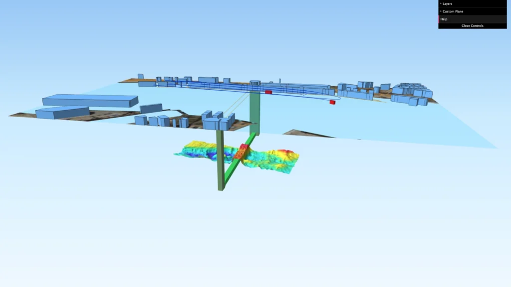
One of the highlights of the operation was the generation of a detailed 3D visualization of the bathymetric survey area. This dataset showcases the high-resolution underwater topography captured during the campaign. It highlights SBG’s systems’ performance in complex marine environments.
We invite hydrographic professionals and researchers to explore this 3D bathymetric survey and assess its data quality. The visualization showcases the system’s precision and highlights how advanced inertial technology improves modern marine survey results.
How to use the 3D Survey visualization:
1 – One continuous click with 1 finger for a 360º move.
2 – Use trackpad 2 fingers gesture for zoom in/out
3 – Select all features you want to be presented (e.g. colors, survey line, etc.)
Get full access to other SBG Systems’ products test reports.