Coordinate Reference System (CRS) is the essential framework that gives geographic data meaning. You can think of a CRS as the language that tells you where a location is on Earth, relating two-dimensional coordinates (like latitude and longitude) to a real-world position. Without a CRS, a set of coordinates is just a meaningless pair of numbers; the CRS transforms these numbers into a measurable, verifiable location.
Every CRS consists of several interdependent components. The datum is the fundamental piece, defining the shape and size of the Earth—an ellipsoid (a slightly flattened sphere) that best approximates the geoid (the actual, irregular shape of the Earth based on gravity). The datum specifies the reference ellipsoid and its position relative to the Earth’s center of mass. For example, the widely used WGS 84 datum uses an ellipsoid and an origin point crucial for GPS functionality.
Projection parameters prevention
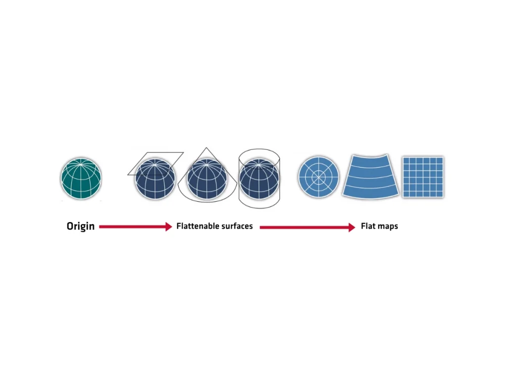
A projection is a mathematical model that flattens the three-dimensional curved surface of the Earth onto a two-dimensional map plane. This process invariably introduces distortion, affecting shape, area, distance, or direction. Different projections minimize specific types of distortion. For instance, a Mercator projection preserves angles and shapes (useful for navigation), but drastically exaggerates areas near the poles. A CRS defines the specific projection parameters, including the central meridian, standard parallels, and false eastings and northings, which shift the origin to prevent negative coordinates.
The CRS defines the coordinate system itself. This system specifies the axes, such as North-East or Latitude-Longitude. It also establishes the units of measurement, like meters or degrees. CRSs have two primary classifications. Geographic Coordinate Systems (GCS) are one type.
GCS use spherical coordinates, like latitude and longitude. They are directly based on a datum (e.g., WGS 84). Projected Coordinate Systems (PCS) are the second type. PCS use planar coordinates, like Northing and Easting. They measure in linear units (e.g., Web Mercator or a UTM zone).
Conversion and transformation
Understanding the specific CRS of your data is critical. Mismatched CRSs are a primary source of spatial errors, causing features to misalign when you overlay different datasets. If one dataset uses the North American Datum of 1983 (NAD 83) and another uses the World Geodetic System 1984 (WGS 84), you must transform or reproject the data to a common CRS before analysis or visualization.
This transformation involves complex mathematical calculations to accurately convert coordinates from one system to another, ensuring spatial coherence and data integrity in Geographic Information Systems (GIS) and remote sensing applications. Always verify and explicitly declare the CRS of your spatial data to maintain accuracy.
