Systems for surveyors
SBG Systems delivers cutting-edge solutions for surveyors, including Navsight range of products, and Qinertia Post-Processing Software for unparalleled accuracy and efficiency.
Our advanced Inertial Navigation Systems ensure precise positioning and orientation in even the most challenging environments, whether you’re conducting aerial, land, or marine surveys. Paired with Qinertia’s powerful tightly coupled PPK and tighlty coupled PPP algorithms, surveyors can enhance their data quality, achieving centimeter-level accuracy. Streamline your workflow with seamless GNSS integration, customizable outputs, and detailed reports that meet your project needs.
With our solutions, surveyors gain the tools to execute high-precision surveys with confidence and efficiency across any terrain or waterway and with any type of payload including camera, LiDAR and hyperspectral sensors.
Comprehensive solutions for surveyors
Designed for land, air, and marine operations, Navsight offers robust performance even in GNSS-denied areas, delivering reliable data under the toughest conditions. Whether mapping rugged terrains or navigating complex waterways, Navsight systems empower you with the tools to achieve high-quality results and efficient workflows.
Explore how Navsight elevates your navigation accuracy across land, air, and sea.
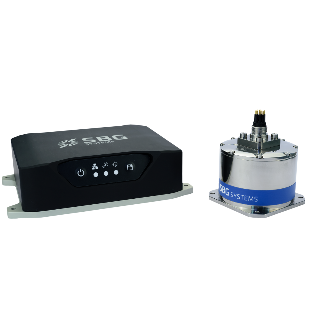
Navsight Marine
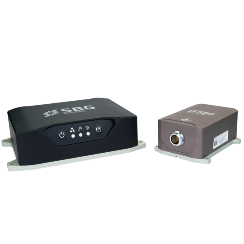
Navsight Land-Air
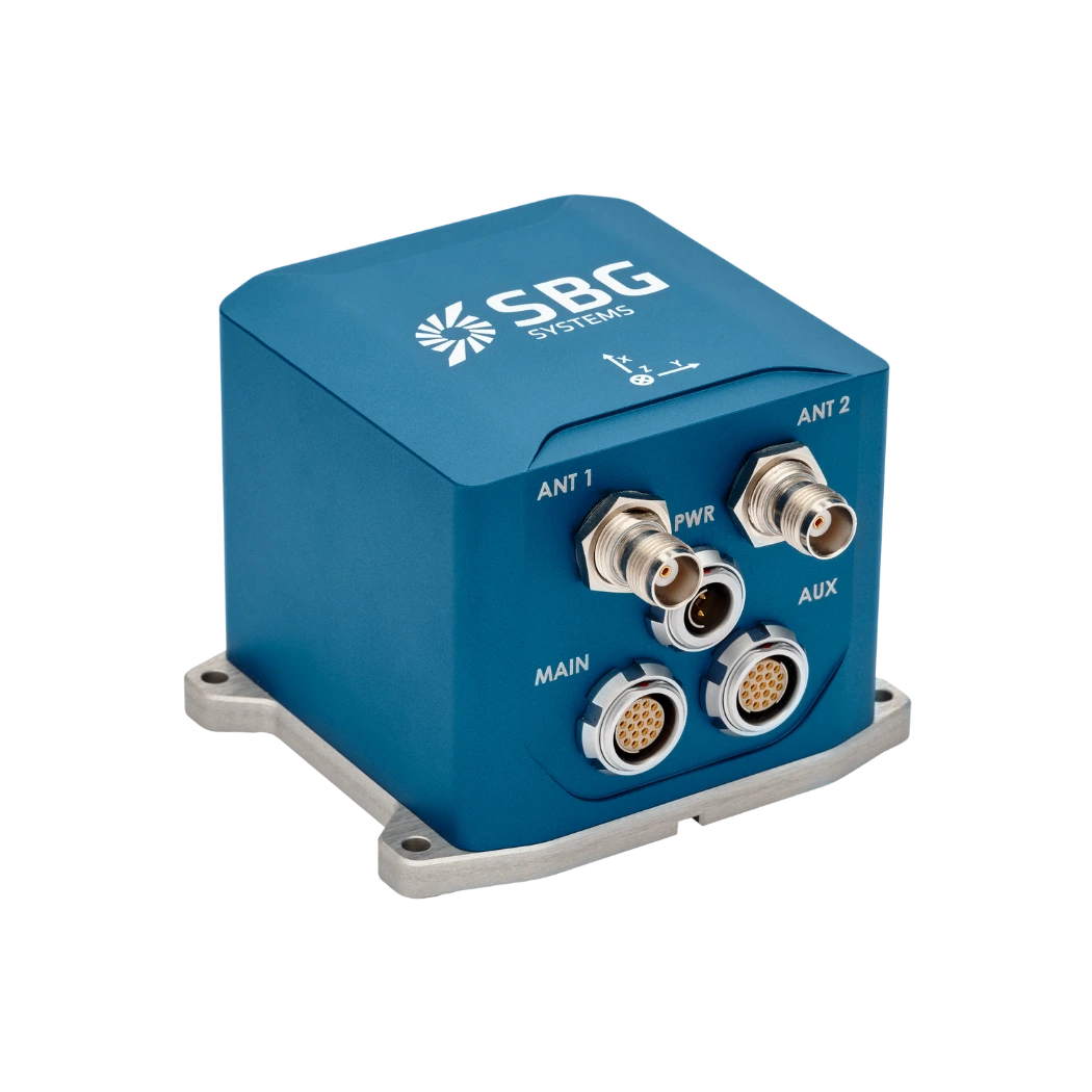
Ekinox-D
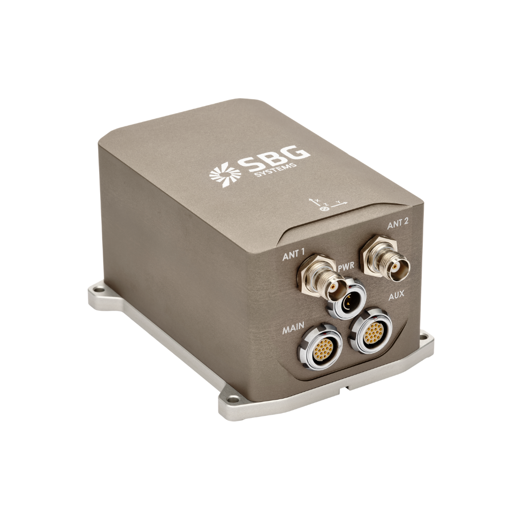
Apogee-D
Surveyor’s software suite
Designed with surveyors in mind, Qinertia GNSS+INS Post-Processing Software (PPK) offers an intuitive user interface, fast processing speeds, and seamless compatibility with third-party GNSS receivers and base stations. It includes a comprehensive QC toolkit, an integrated base station database, and direct access to precise ephemeris and correction services to simplify and automate the processing workflow.
Qinertia also features a unique Lever Arm Estimation tool, a significant advancement in system calibration and integration. This built-in tool allows users to automatically estimate the lever arms between the GNSS antenna, IMU, and additional sensors—directly within the software. This eliminates the need for complex field calibration setups, saving time and reducing human error. Utilizing advanced algorithms and real trajectory data, the tool delivers highly accurate and reliable estimates, enhancing users’ ability to improve overall system alignment and navigation accuracy.
Whether for UAV mapping, mobile scanning, or hydrographic surveys, Qinertia and its Lever Arm Estimation tool empower professionals to streamline operations, enhance precision, and gain full confidence in their data.

Qinertia GNSS-INS

Qinertia Lever Arm
Access our systems for surveyors brochure
You can download our brochure directly to your inbox!
Advantages of choosing our Navsight solutions
SBG Systems’ Navsight solutions are designed to simplify and enhance mobile data collection for professional surveyors across land, air, and marine environments. Combining advanced Inertial Measurement Units (IMUs) with GNSS receivers and a powerful processing unit, Navsight delivers reliable position, orientation, and motion data—even in challenging or GNSS-denied conditions.
Whether you’re conducting hydrographic surveys in shallow or deep waters, or capturing precise data in terrestrial or aerial mapping missions, Navsight adapts to your operational needs. Its modular architecture includes a rugged processing unit, high-grade IMUs (Ekinox, Apogee, or Horizon), and flexible interface options for integration with LiDAR, cameras, and more. With easy setup, real-time data output, and high adaptability, SBG Systems’ inertial navigation solutions help surveyors streamline their workflows and achieve the highest accuracy in every mission.

Discover our navigation systems and ppk software
Complemented by our Qinertia post-processing software, surveyors can achieve centimeter-level accuracy, streamlining operations and improving data quality. It is a next-generation GNSS/INS post-processing software designed to deliver centimeter-level accuracy for professionals in surveying, mapping, hydrography, and UAV photogrammetry. By combining raw GNSS data with inertial measurements, Qinertia refines positioning and orientation information, ensuring reliable results even in challenging environments.
Advanced functionalities like IonoShield mode for managing ionospheric activity, RTS smoothing for trajectory refinement, and support for various motion profiles make Qinertia a versatile tool for diverse applications. With SBG Systems solutions, you can confidently tackle complex surveying projects with efficiency and precision.
Discover all our motion and navigation solutions.